Langtang – Gosaikunda Circuit TreK

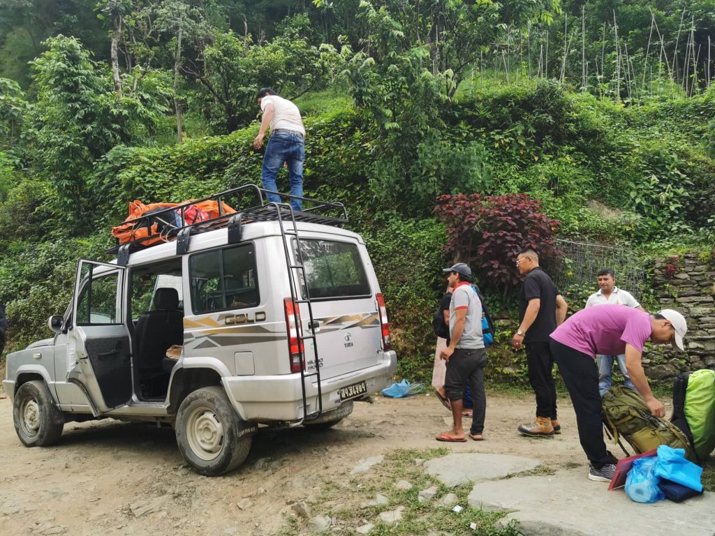
Day 01. Kathmandu to Syabrubesi 1450m — 7 hrs

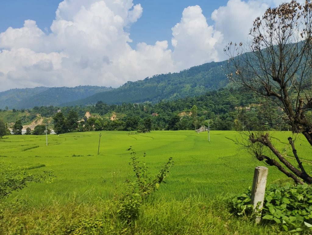
We boarded Scorpio from Kathmandu at 7:15 am. Unwillingly, there was a traffic jam from Thankot due to the accident. After a while, our jeep moved ahead and turned right from Galchhi. We could see beautiful paddy fields along the way. We continued ahead without stopping at our regular lunch place Trishuli.

We were looking for cool place upwards for lunch. But we had to take longer and alternative road due to landslide. Later we rejoined regular road at Dharapani and had our lunch also. Then we continuously drove to Syabrubesi.

Day 02. Syabrubesi to Rimche 2450m – 8 hrs

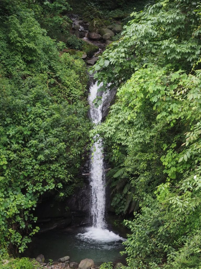
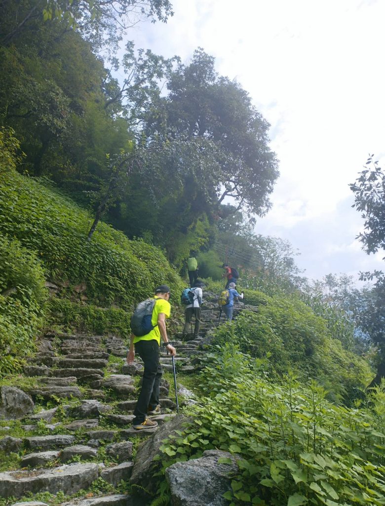
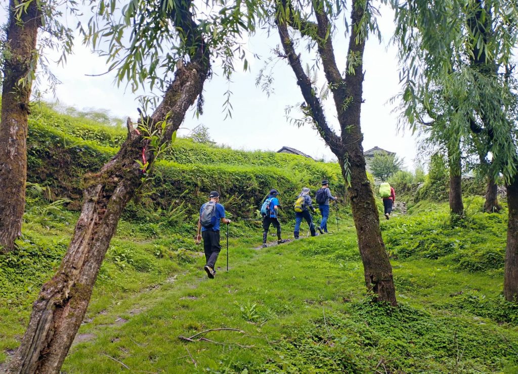
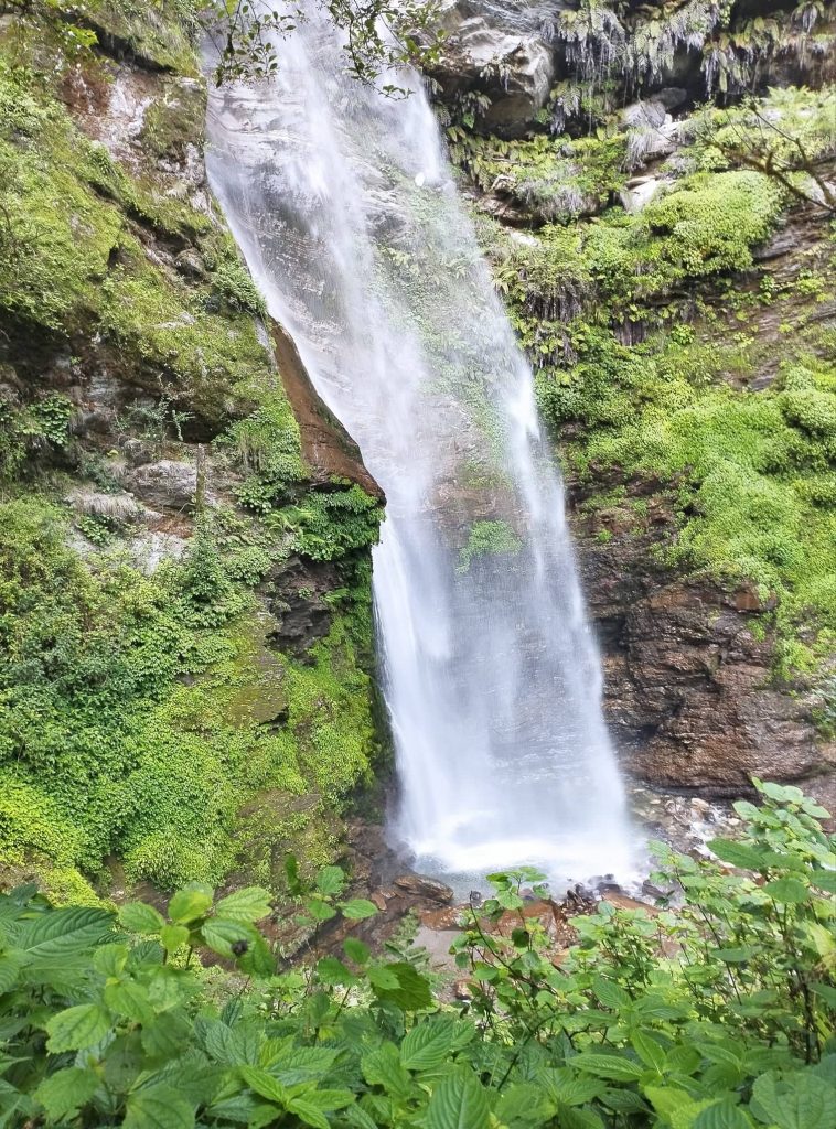
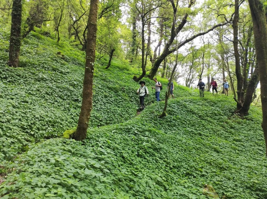
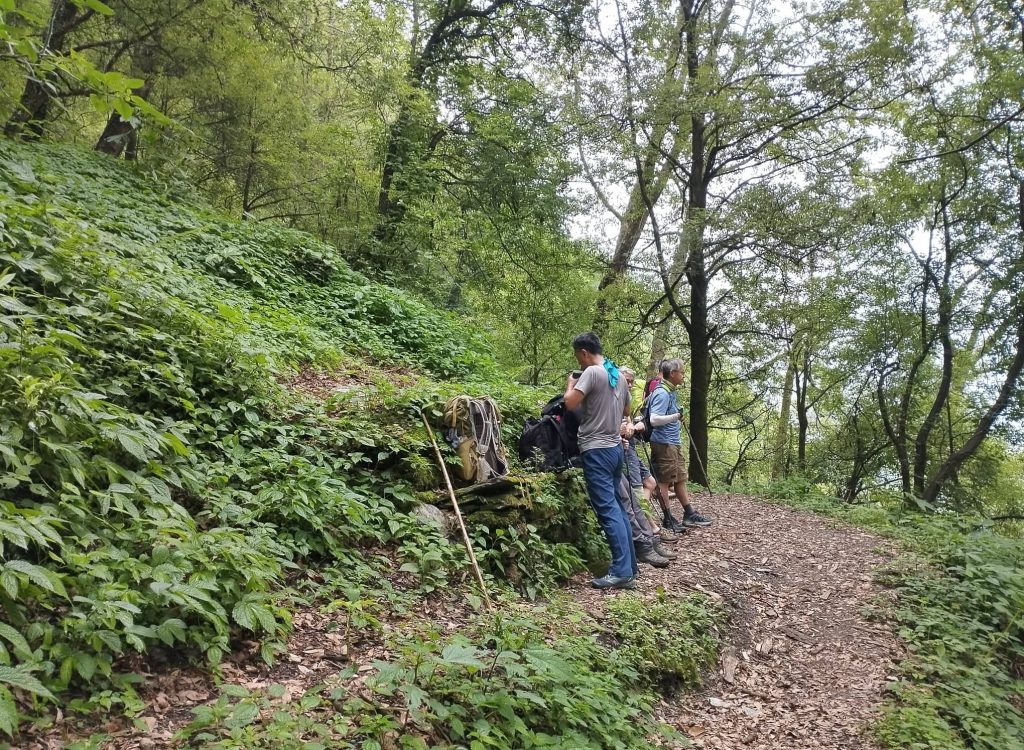
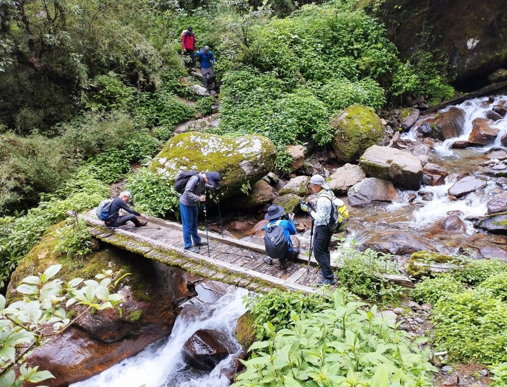
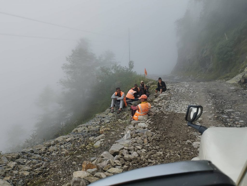
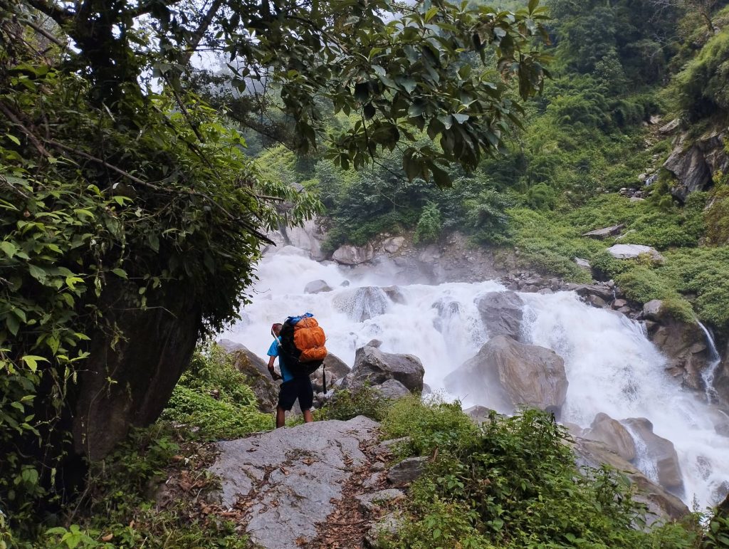
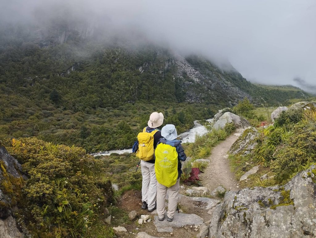
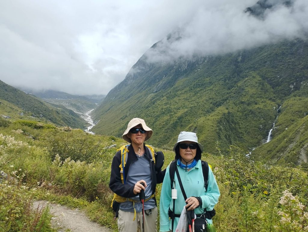
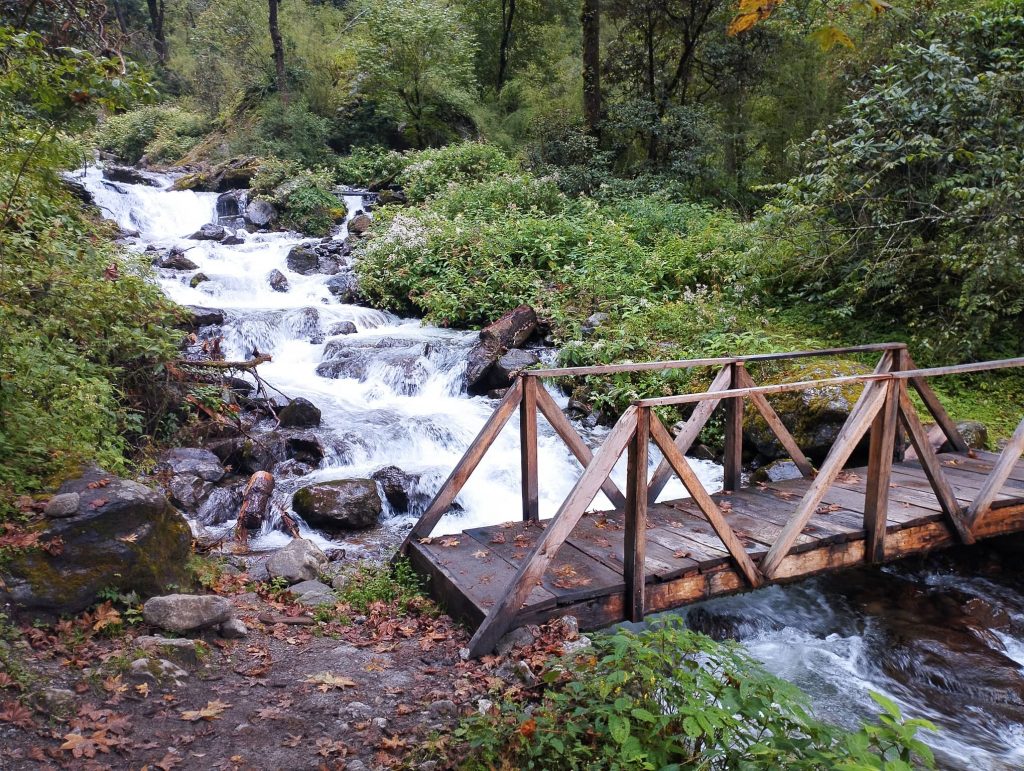
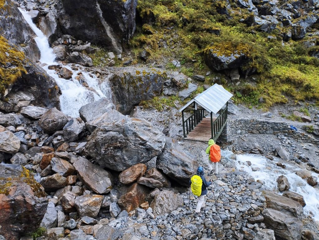
Our clients were ready for breakfast earlier than me. After breakfast we set off at around 7:15am from Syabrubesi. Shortly after leaving from Syabrubesi, we crossed Timure khola and followed the Langtang khola. We followed the dirt road until Dovan. Then we followed regular trekking trail. It was pretty greenery and numerous waterfalls along the way. After tea-break at Pahiro, we headed to Bamboo for lunch. There were several landslide parts on the way because of monsoon.

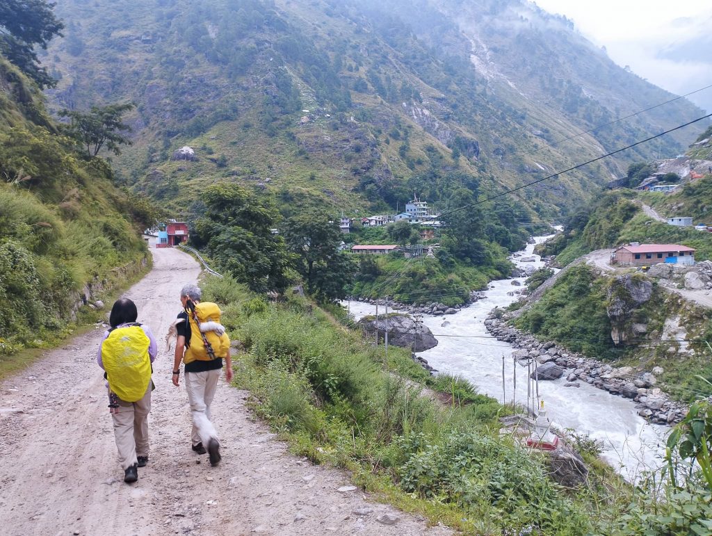
After crossing Dangdunge bridge, we ascended until get to Rimche. We reached to Rimche at around 2:30pm, quite faster than our estimated time. Later many pilgrims were coming from different villages. Luckily, they all went to Lama hotel for overnight stay. So, we could sleep peacefully.

Day 03. Rimche to Langtang 3500m – 7/8hrs

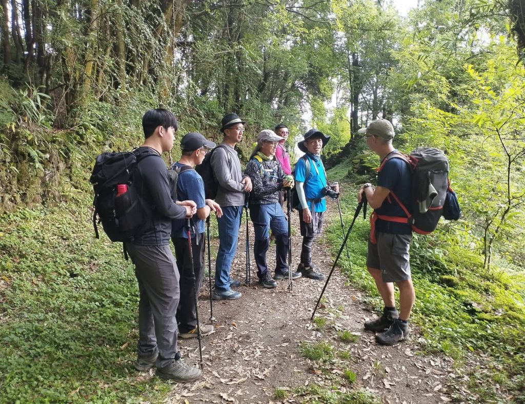
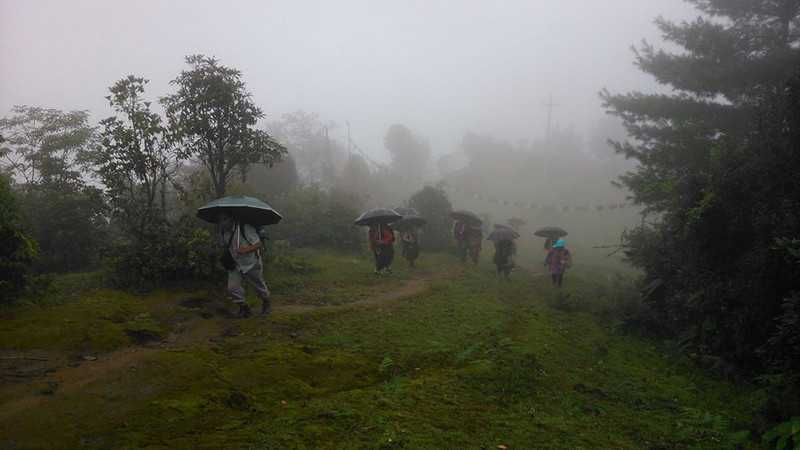
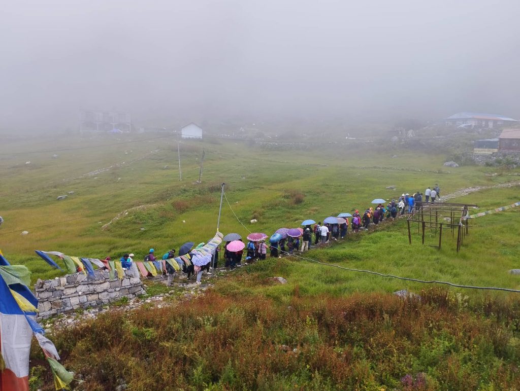
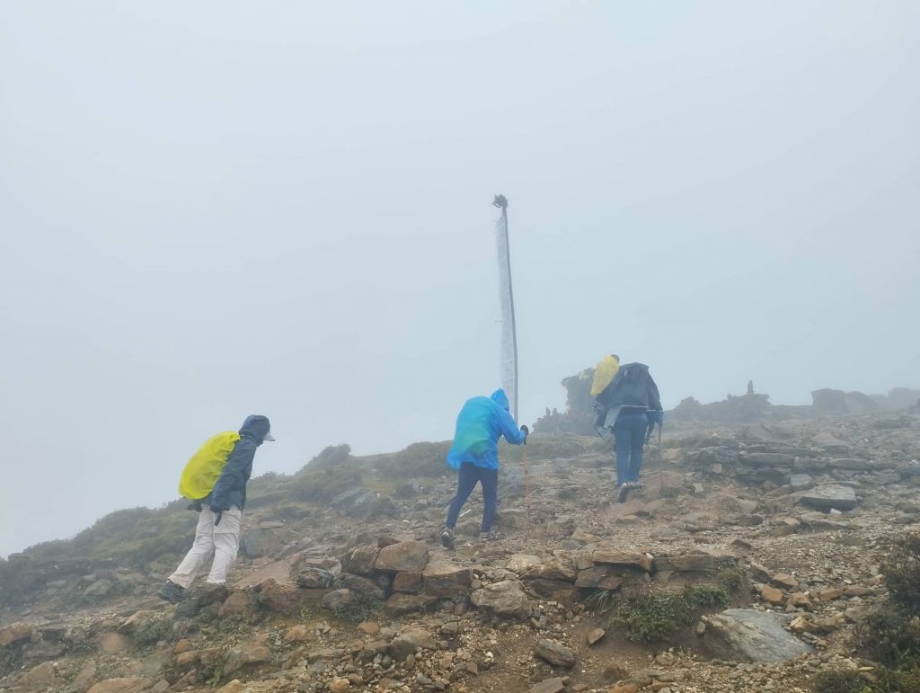
Since mid – night, it was raining continuously. As we expected, stopped raining in the morning. We left Rimche at around 7:30am with misty weather. Pilgrim groups had already left while we reached to Lama hotel. We met them only at Riverside where they were taking break with singing and dancing. There were more ladies than guys with theirs’ traditional costume.

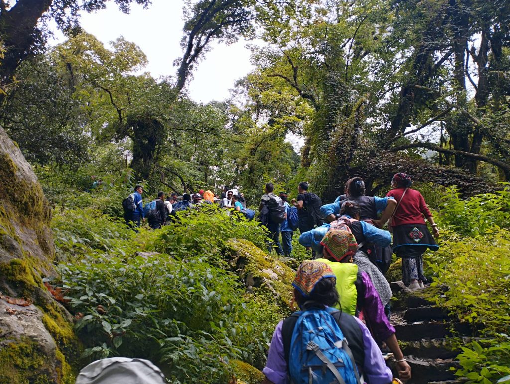
Then we also walked together with pilgrim groups. It was fun to some extent though they would block the trail frequently by dancing and singing. We slowly tried to overtake the dancing groups. For that, we had to walk a bit faster which gave a bit pressure to our clients. There were very few other trekking groups on the way. some of them were joining with dancing groups. Because of early season, tea- houses at Ghoda-Tabela were closed. So, we had to trek further to Thangsyap for lunch. Only one tea- house was opened at Thangsyap also. So, it happened next big gathering of all trekkers and pilgrims there.

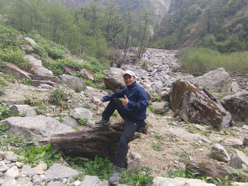
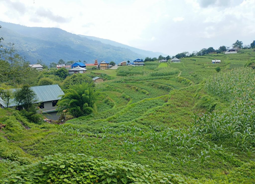
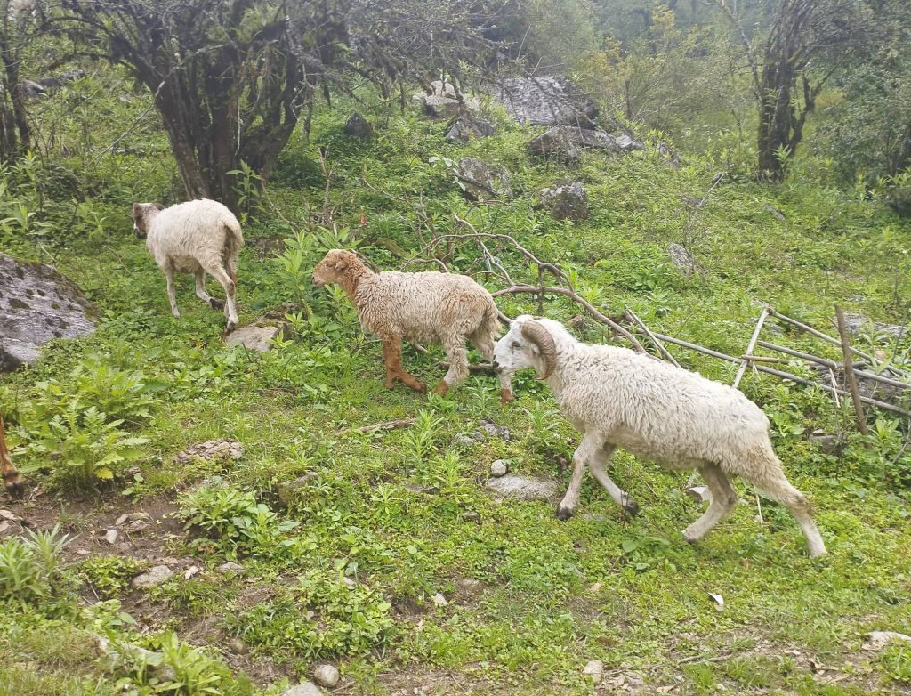
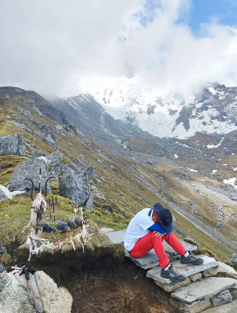
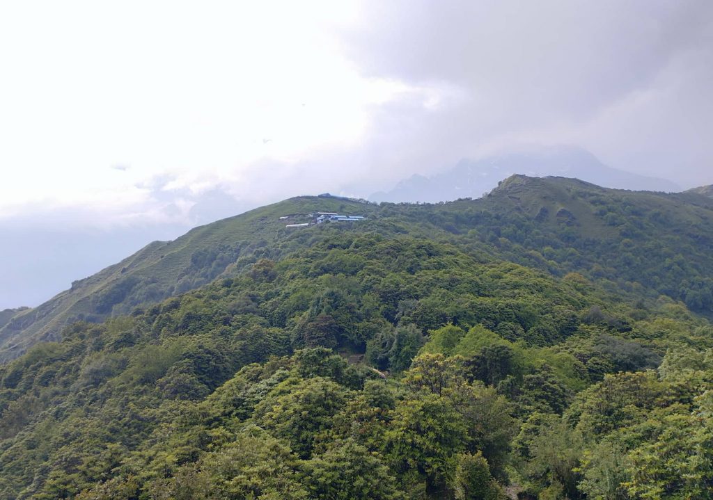
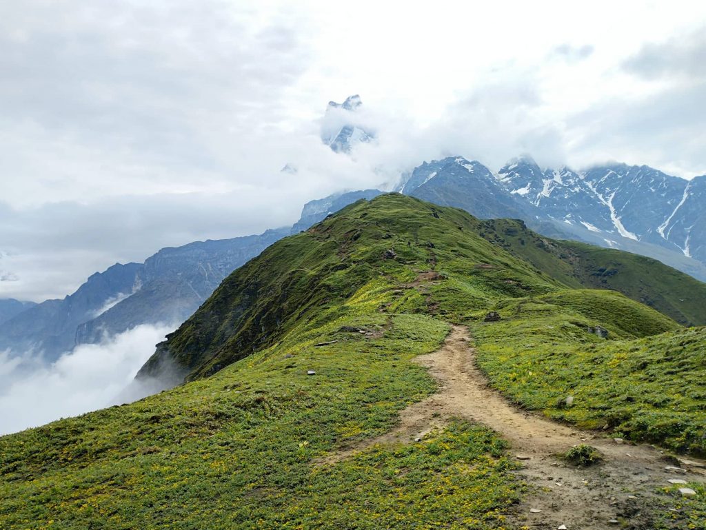
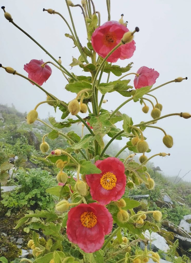
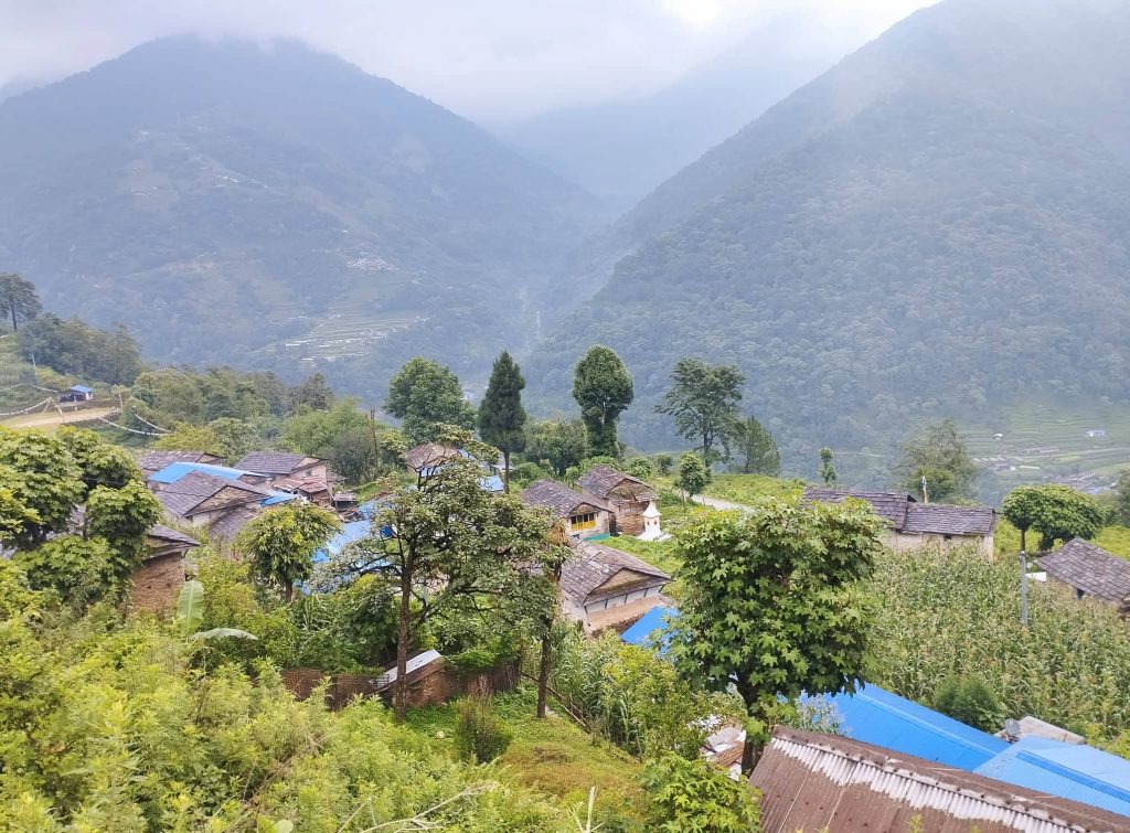
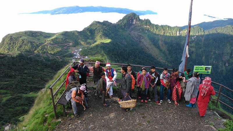
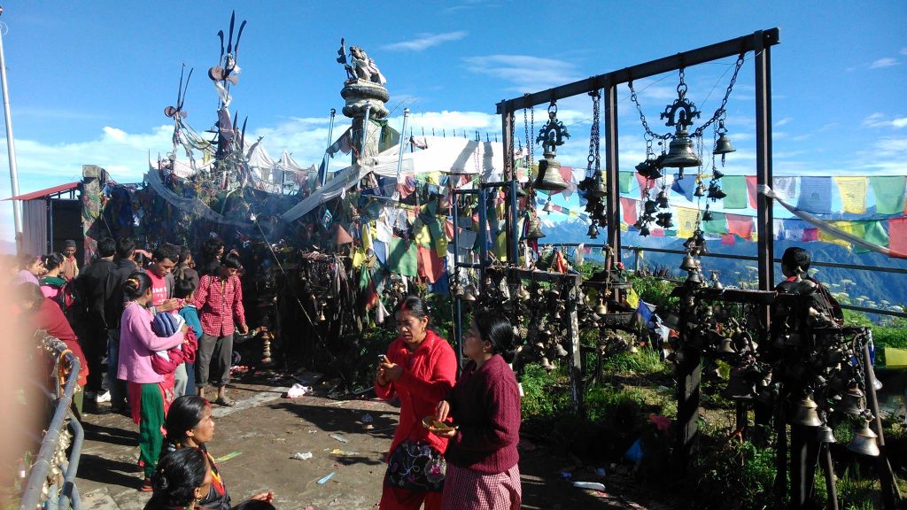
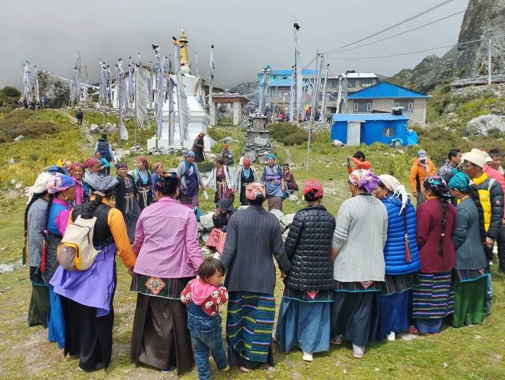
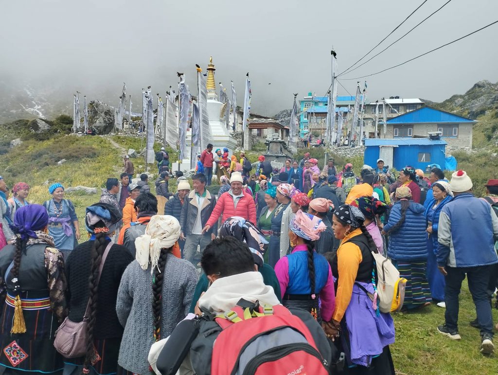
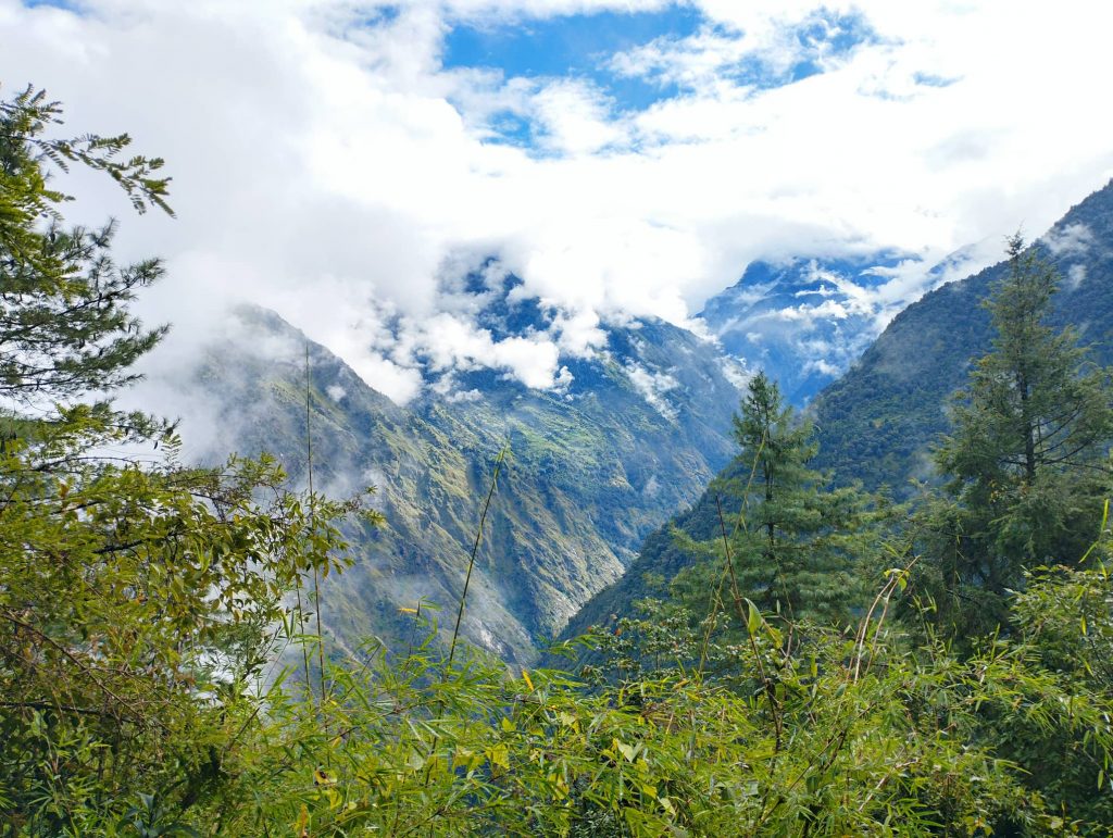
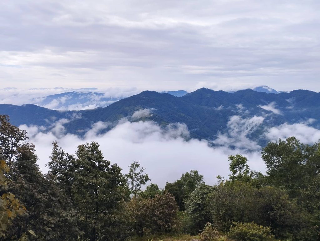
After lunch, we moved before than pilgrim groups. Though it was cloudy, we enjoyed trek with gentle ascending and seasonal flowers on the way. Finally, we crossed the huge landslide part of 2016 earthquake and reached to Langtang. Whole village looked busy to welcome and prepare lodging and food for pilgrim groups. Although they are Buddhist, seems they have high respect to Shaman and great practice of shamanism.

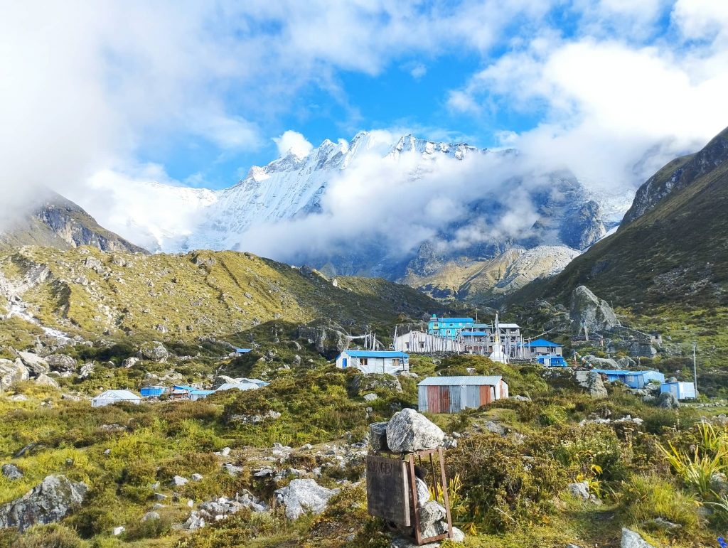
Day 04. Langtang to Kyanjin 3800m – 4hrs

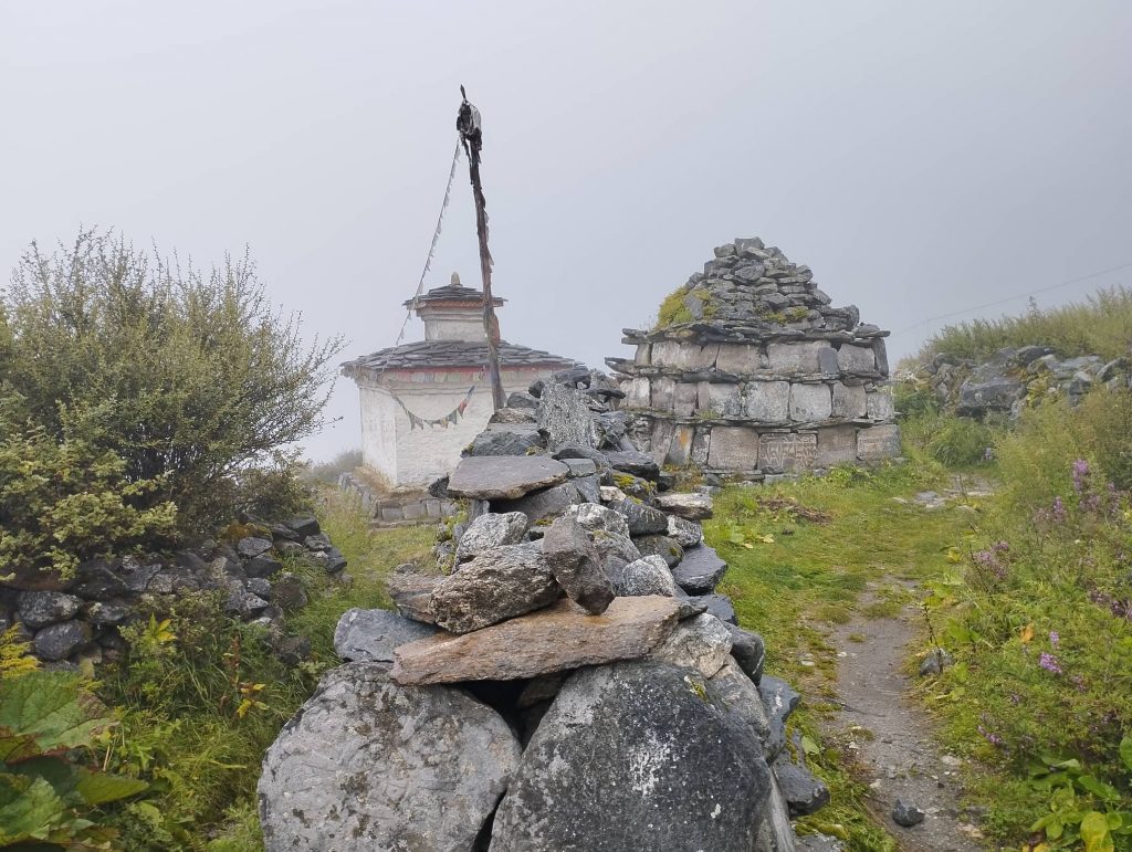
Weather was misty even in the morning. We set off to Kyanjin at regular time even though it was half day trek. It was gradual uphill all the way to Kyanjin. After passing Mundu village, we met pilgrim groups again. We moved ahead while they were engaging with welcome program. There were Mani-walls, Stupas and variety of seasonal flowers along the way.

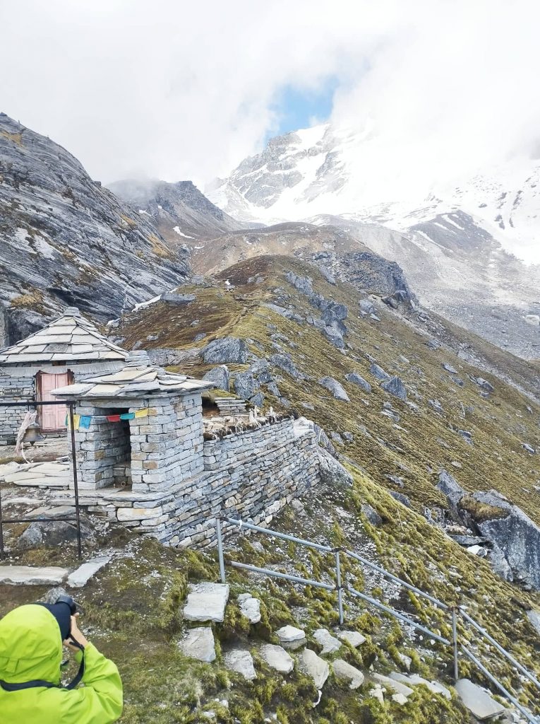
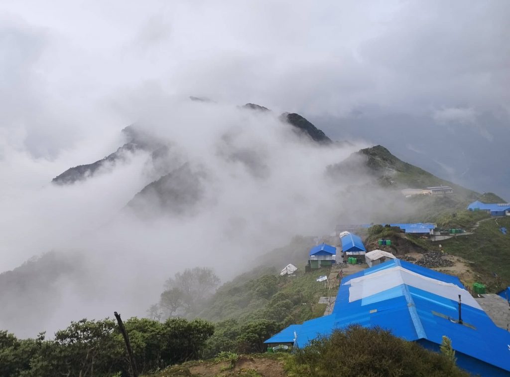
Luckily, we had chance to taste fresh Nak milk tea also on the way. We took just 4hrs to get to Kyanjin. After lunch, we visited cheese factory and also bought cheese little bit. And then we couldn’t walk around due to rain.

Day 05. Kyanjin to Langsisa to Kyanjin – 6hrs

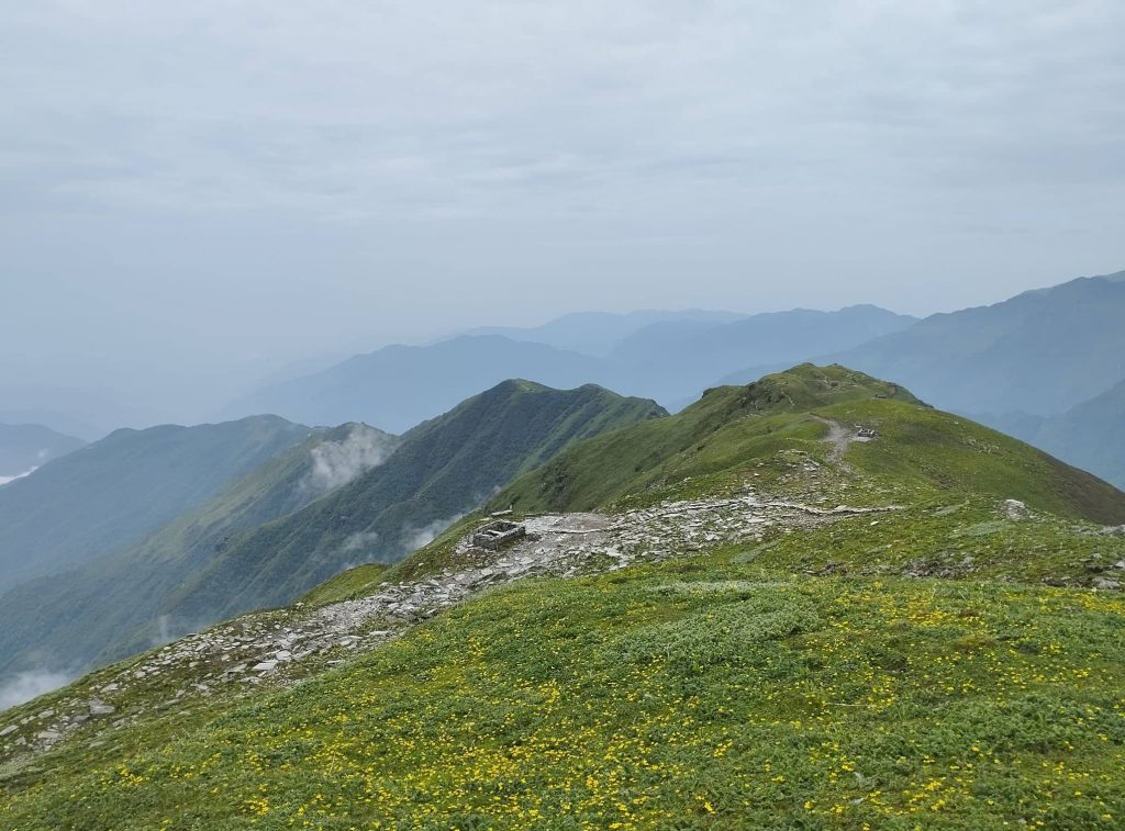
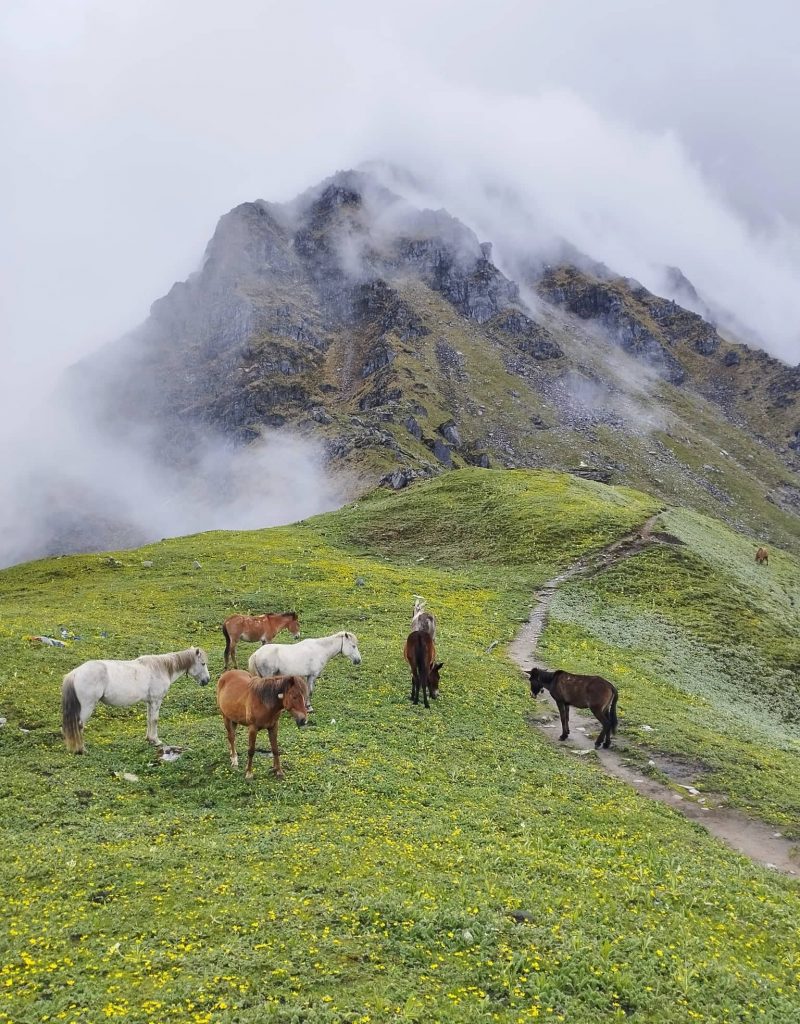
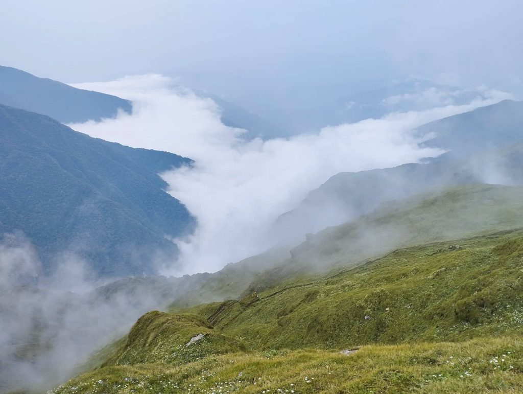
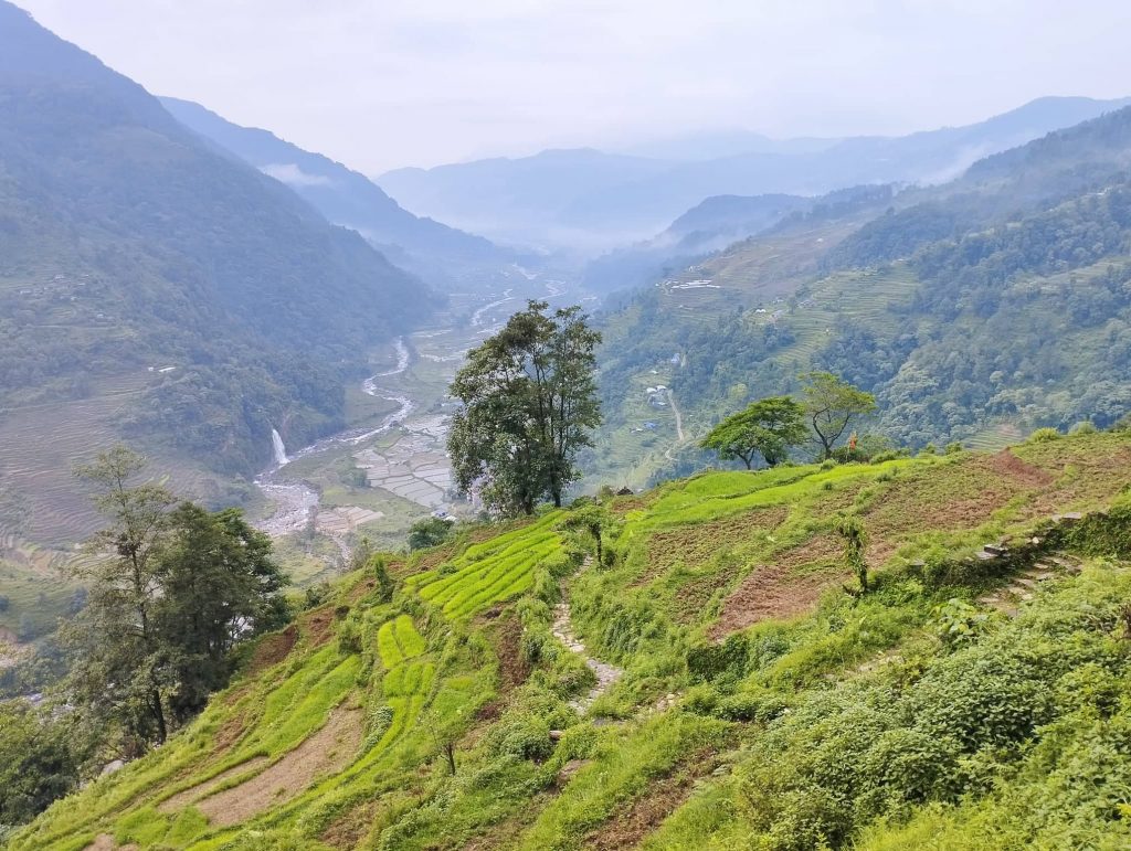
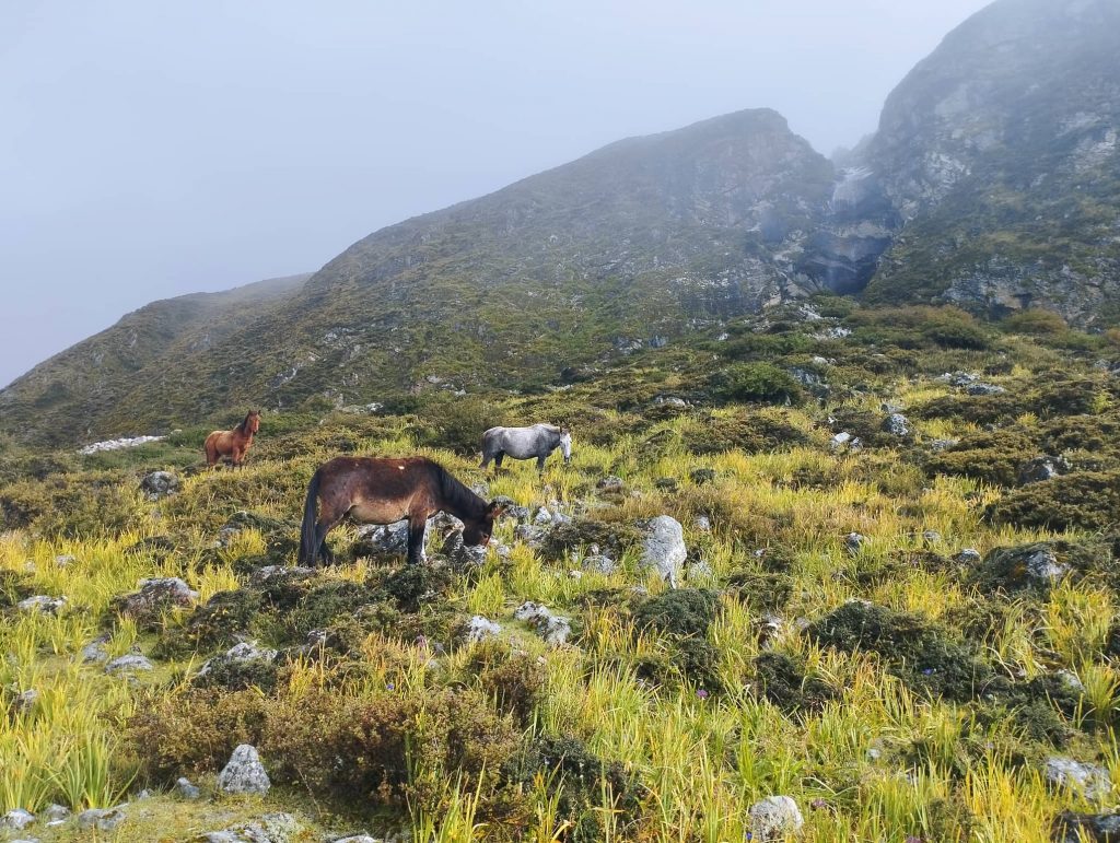
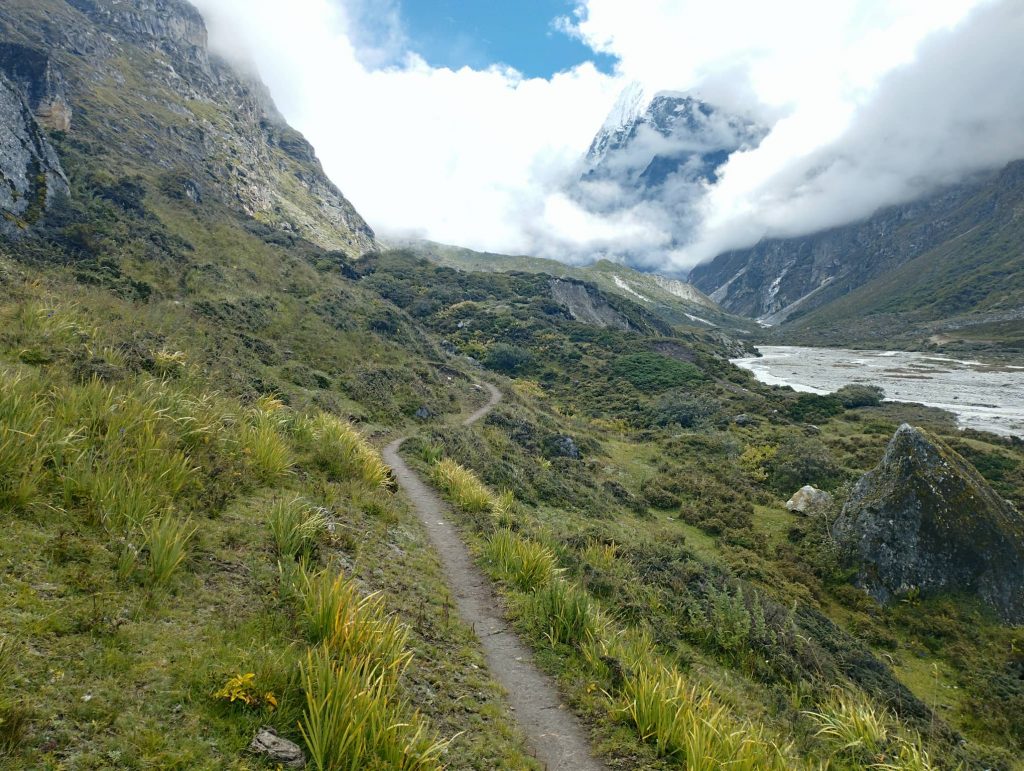
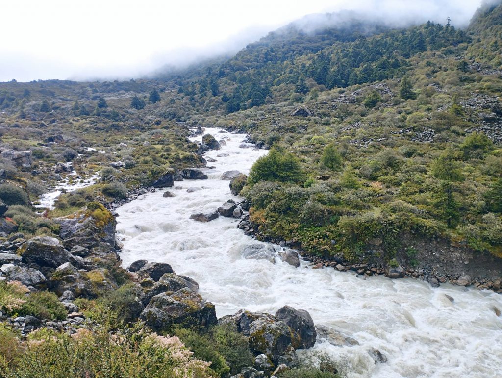
Because of misty weather, i suggested to our clients to visit lake instead of Kyanjin ri viewpoint. After breakfast, our clients headed to Lake with assistant guide and i set off to Langsisa which was main pilgrimage site. It was quite easy trail, no uphills. There were numerous peoples along the way heading to Langsisa. I walked faster than Pilgrim groups as i wanted to get back to Kyanjin again. After half an hour walk from Kyanjin, began beautiful pastureland with greenery. Some horses, mules and Yaks were grazing somewhere on the way. Trail was sometimes through the bank of the Langtang river, sometimes little bit upward.

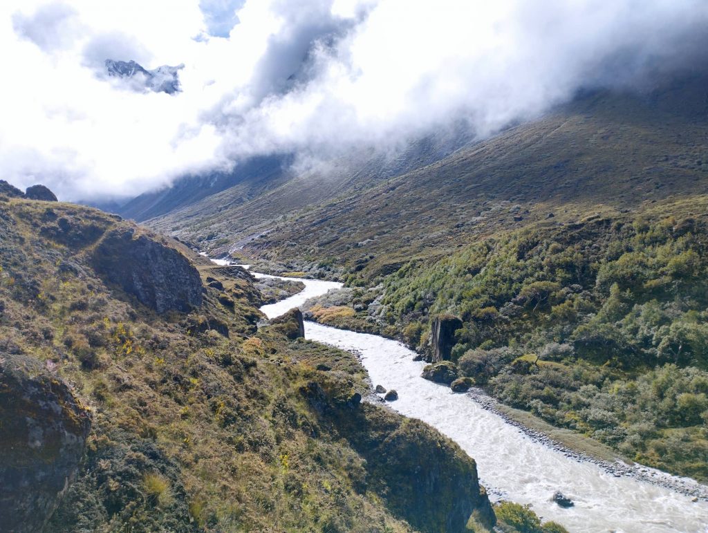
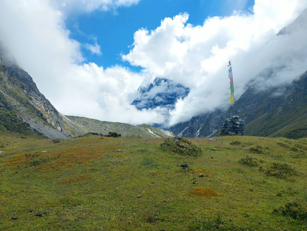
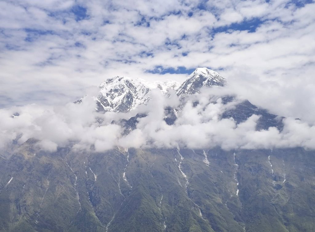
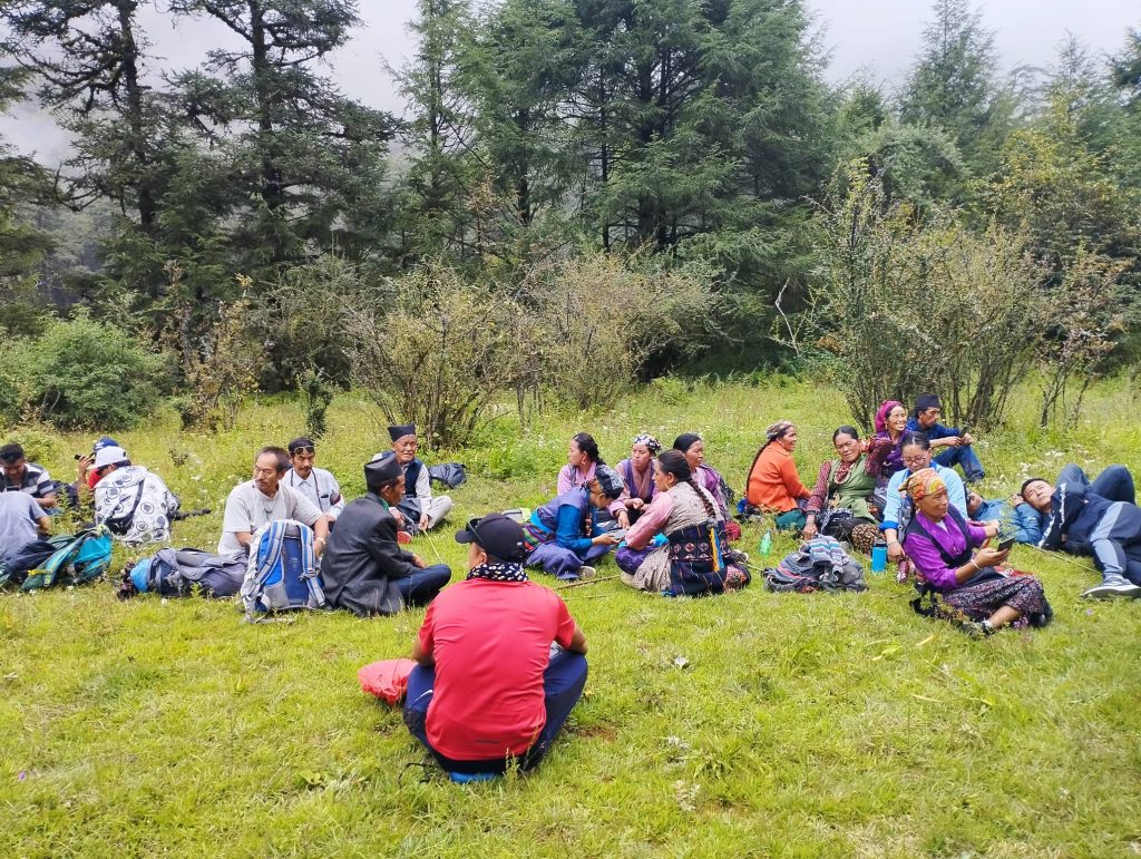
Suddenly weather got clear to some extent. View of Mt. Gang chhyambo with Langtang river looked really stunning. I passed few Yak huts as well on the way.  Just half an hour ago before getting to Langsisa, it was quite uphill around 20min. I took 3 hours to get to Langsisa. There were few Yak huts and a small building at Langsisa. Besides that dozens of dozen sleeping tents had been set up there for pilgrim groups.

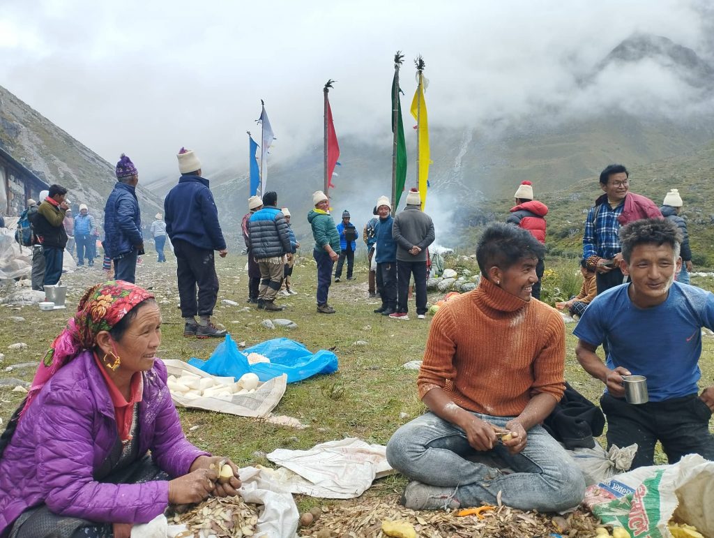
Lamas were performing theirs’ religious retuals since previous day. Other many peoples were busy to prepare food and drinks. They offered me too Syakpa ( like home-made noodle) and butter tea. Slowly other pilgrim groups also arrived one after another. But it began to rain with misty weather. When main shaman arrived, i got back to Kyanjin. I missed theirs’ exciting groups dance and other retuals. I met almost half of the pilgrims on the way heading to Langsisa. Despite the rain and cold, peoples looked excited and having fun at each other. When all pilgrim groups crossed, i did not meet even shepherds. Just Yaks were getting back to theirs’s huts.

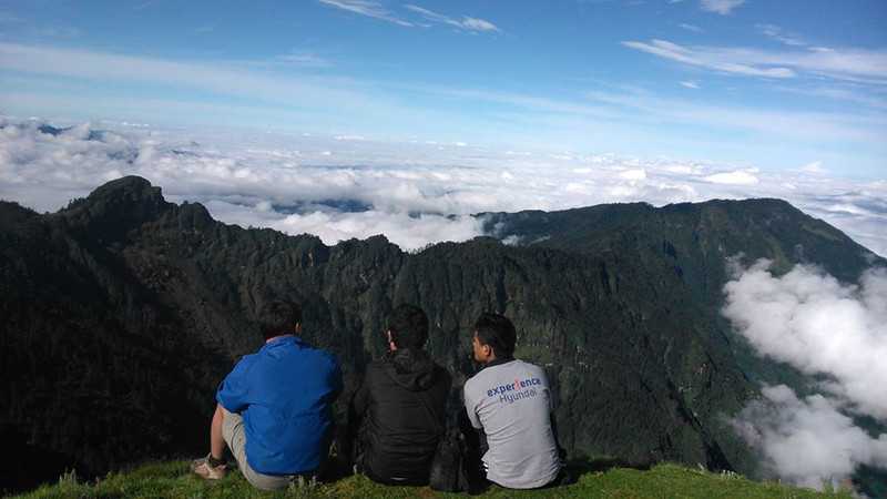
Later rain stopped and appeared sun little bit. It was nice sceneries on the way. It took just 3hrs me to get back to Kyanjin also. I was satisfied with Langsisa trip though it was quite long hike.

Day 06. Kyanjin to Rimche 2450m — 8hrs

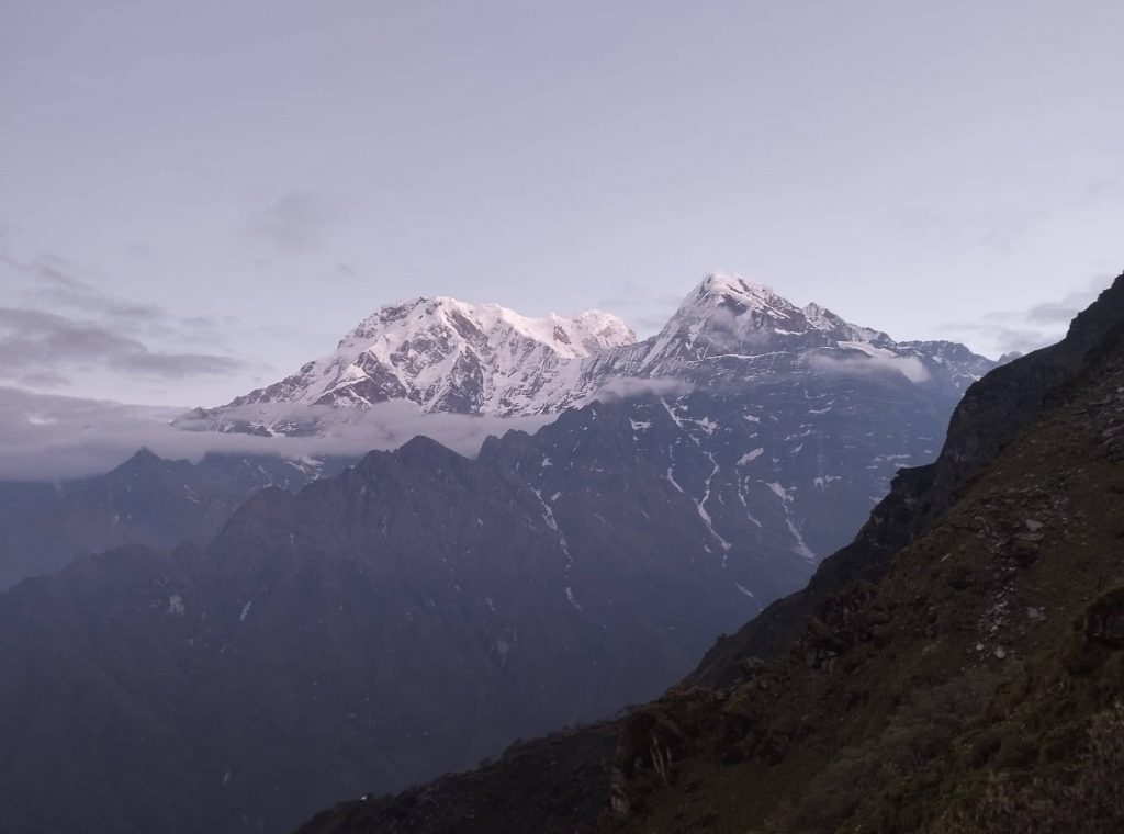
At least morning time, weather got clear to some extent. We could observe few mountains as well. We got down at 7:30am from Kyanjin. Because of heavy rain at night it looked quite fresh scenery along the Langtang river. We took tea-break at Langtang and lunch at Thangsyap.

After lunch weather got cloudy again. It was long distance to get to Rimche. We kept walking without any delay. Trail was muddy and slippery little bit. We took tea-break at Riverside and continued again.Because of misty weather, it looked like semi-dark inside the jungle even at 3pam. Finally, we could be able to get to Rimche at 4:45pm before heavy rain. We all really tired due to almost 10hrs trek.

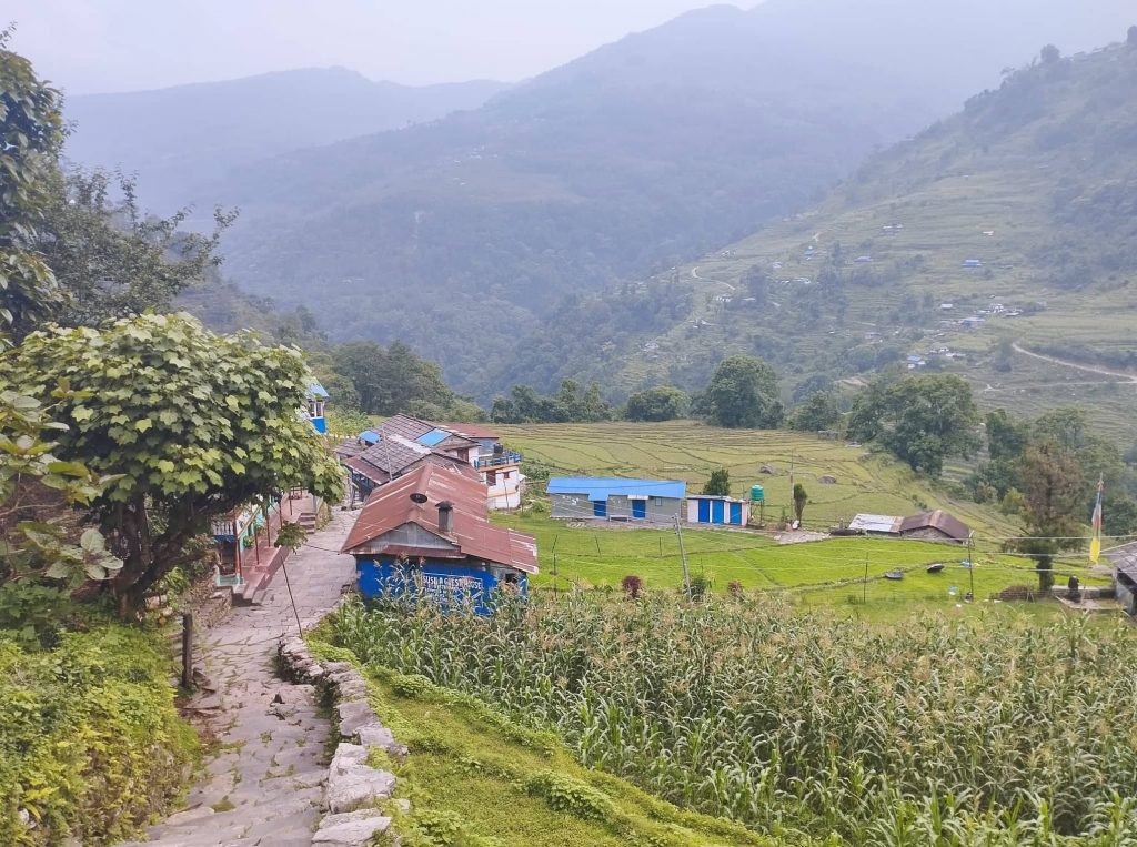
Day 07. Rimche to Thulo Syabru 2540m — 6/7hrs

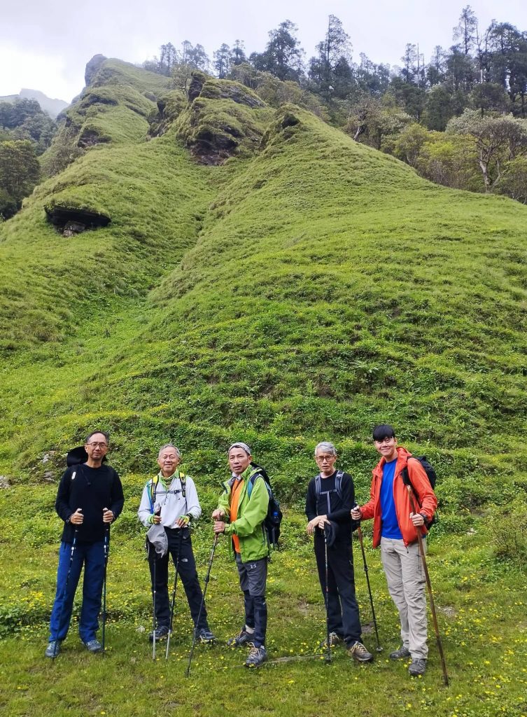
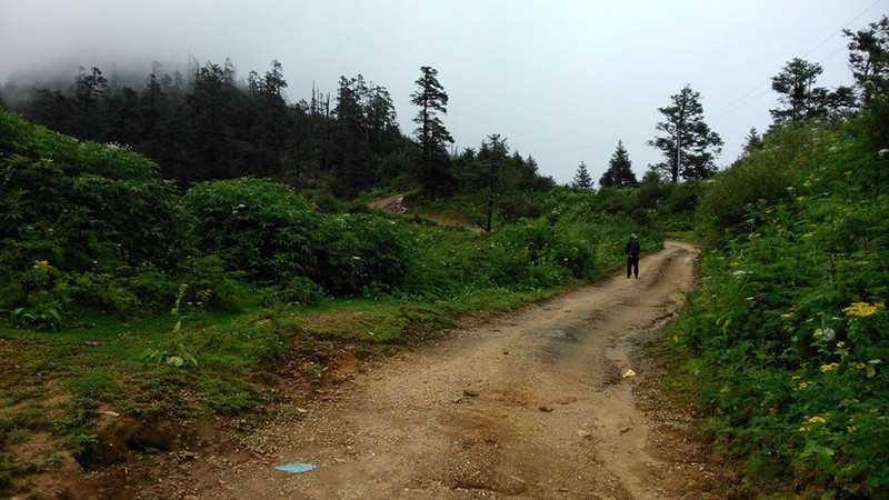
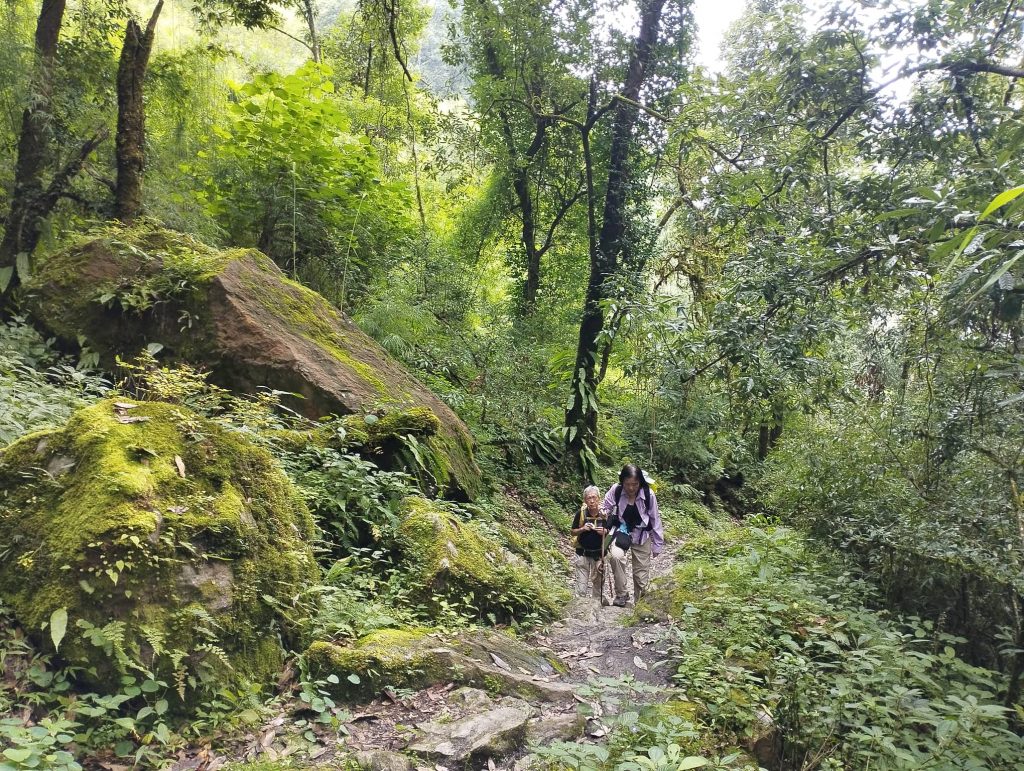
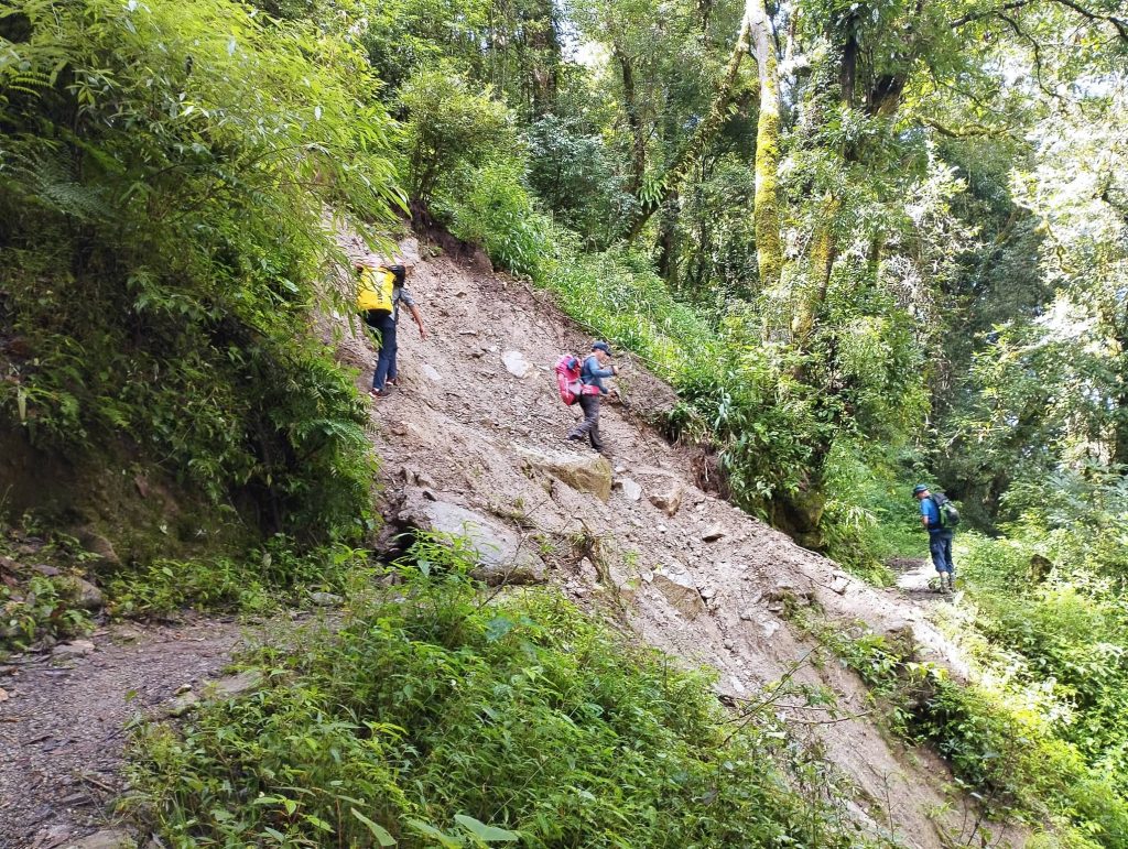
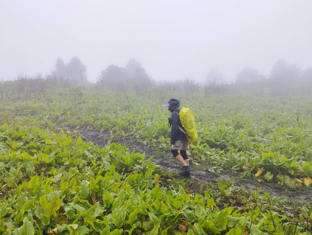
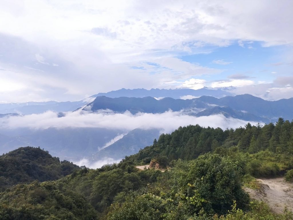
Because of whole night rain, we were a bit concerned about the trail in the landslide part. It was quite clear weather with blue sky. Our group crossed the landslide part together, trail was as it was before. We took tea-break at Bamboo and descended to Pahiro for lunch. Shortly after leaving from Pahiro, we left the way to Syabrubesi and climbed up towards Thulo syabru. It began to rain again and also got some leeches as well.

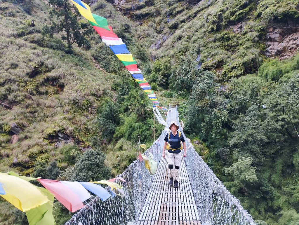
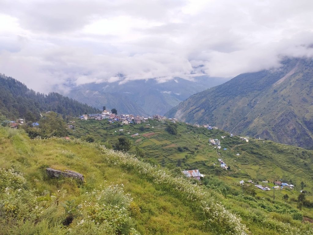
Our clients wore a kinds of socks to protect from leech at  medan. Theirs’ socks looked useful to stop leech bite. After Medan we crossed long suspension bridge and ascended again. Finally we reached to Thulo syabru at around 4pm.

Day 08. Rest day at Thulo Syabru 2540m

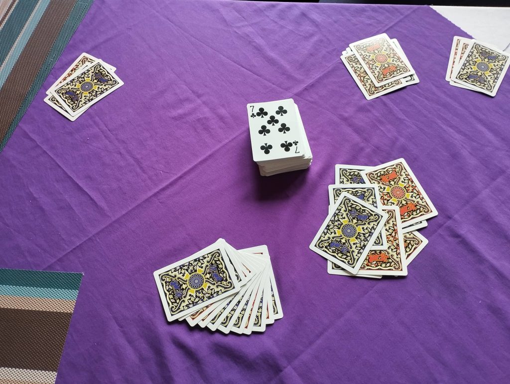
It was our rest day to have rest and wash hiking gears. We couldnt wash our hiking gears at all due to bad weather. So, we enjoyed by playing cards. And we did short village tour in the evening.

Day 09. Thulo Syabru to Sing Gumba 3250m — 6hrs

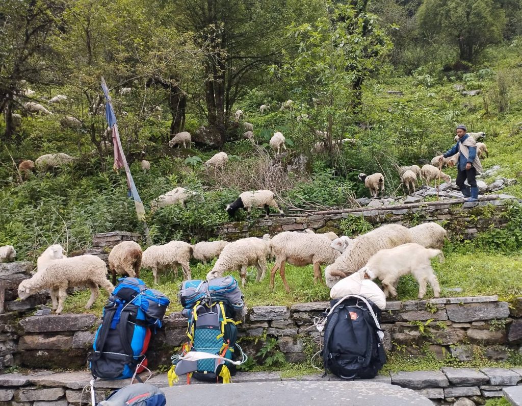
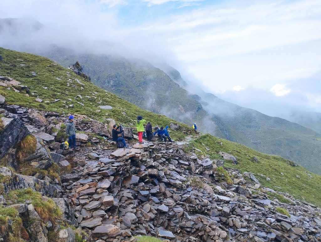
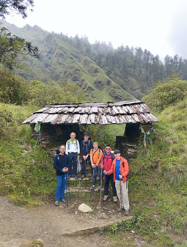
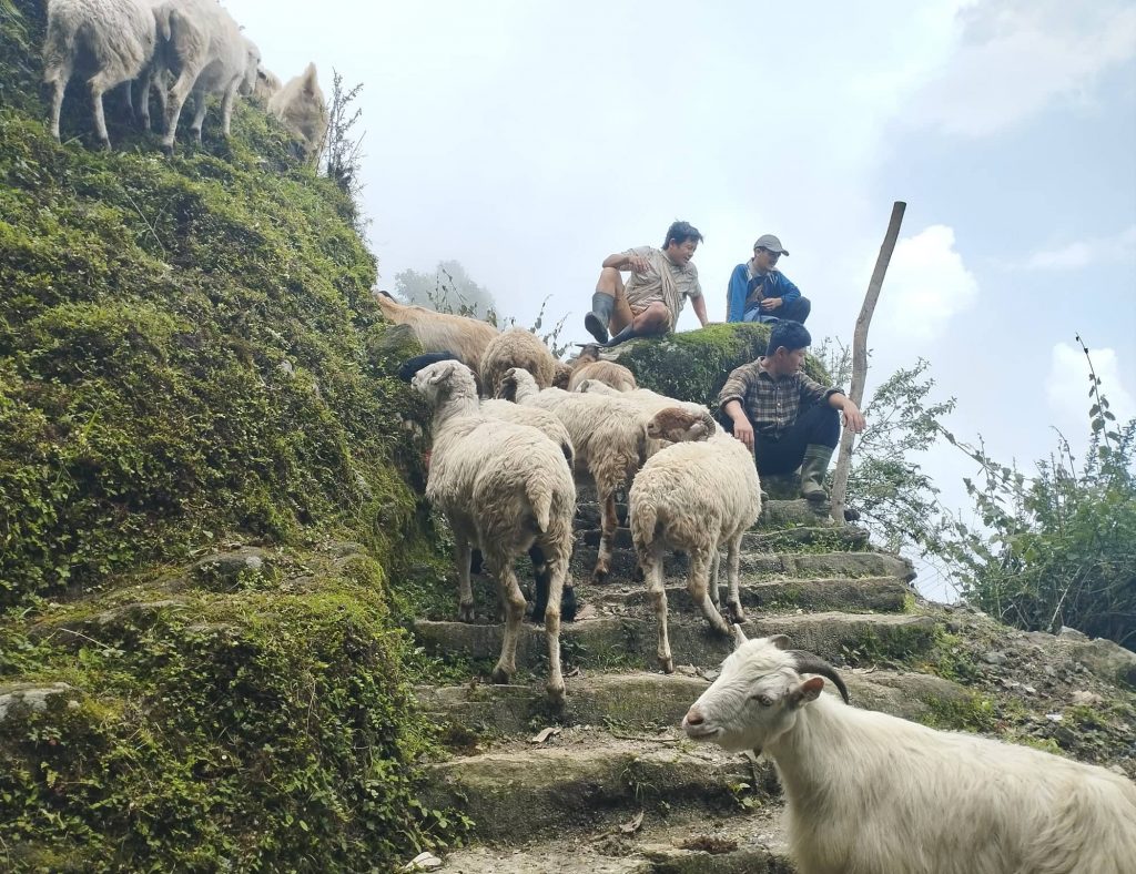
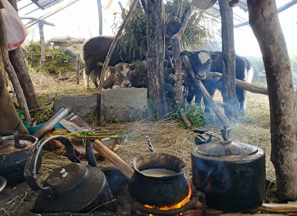
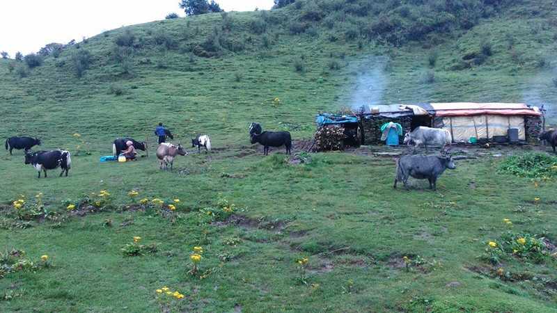
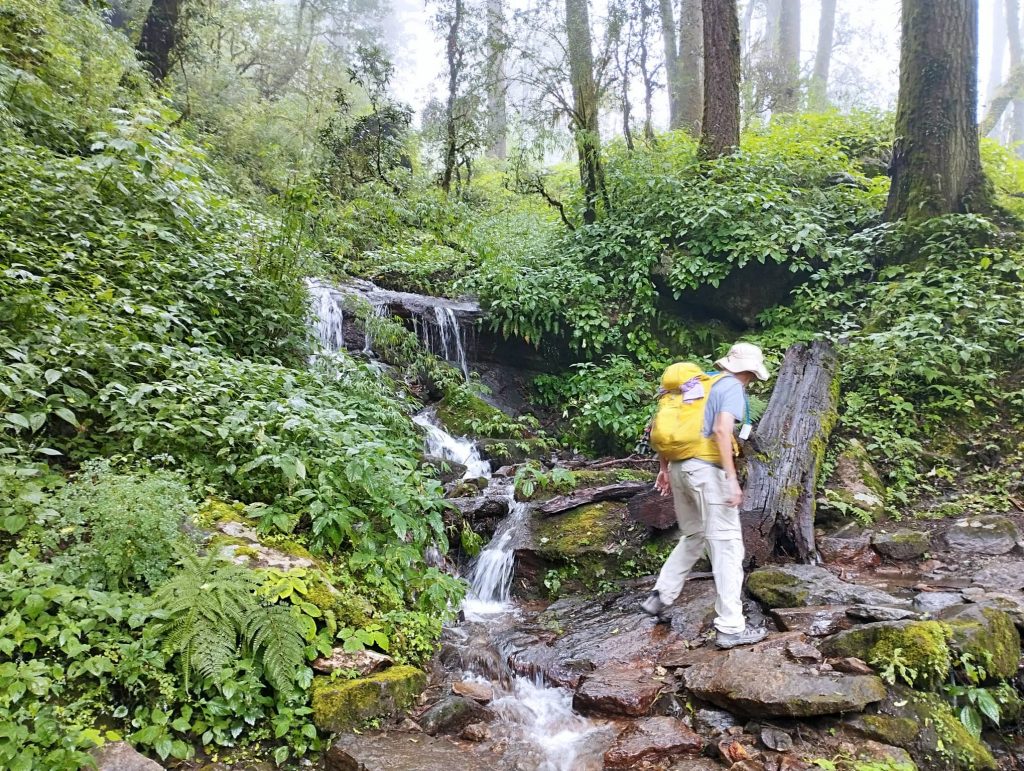
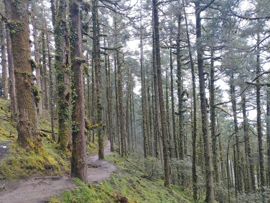
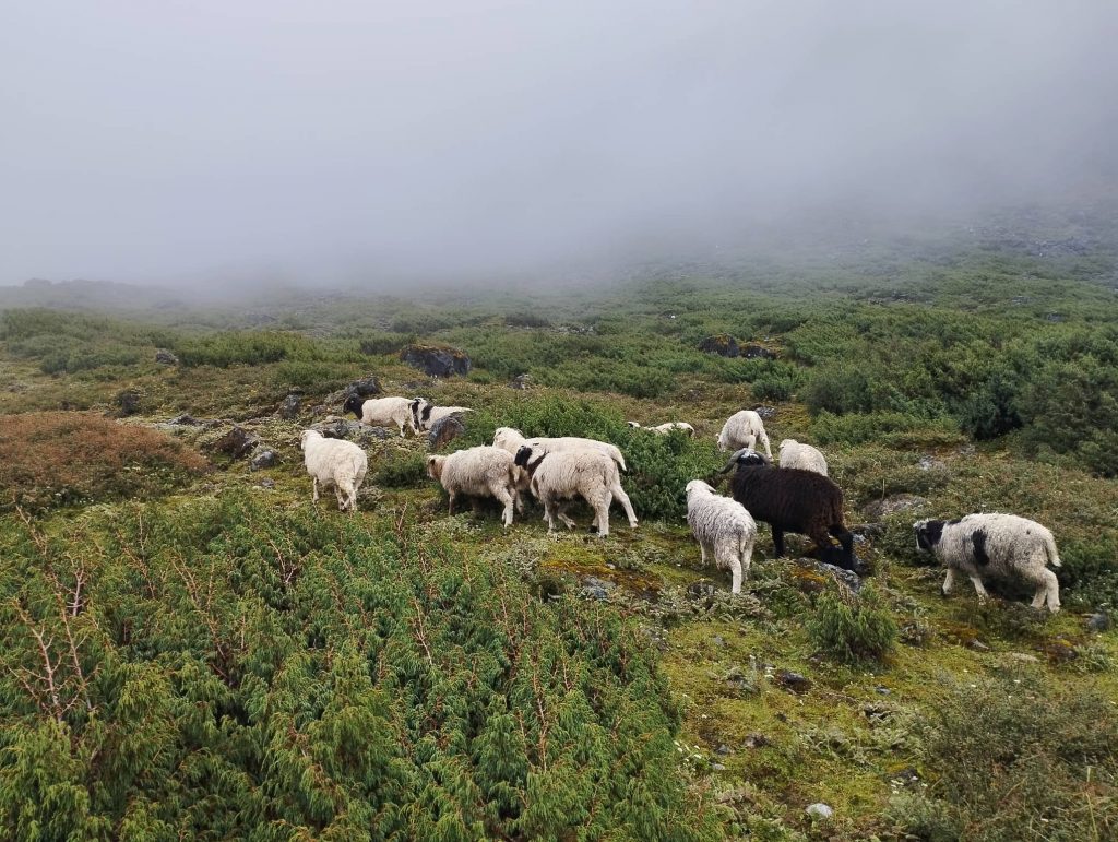
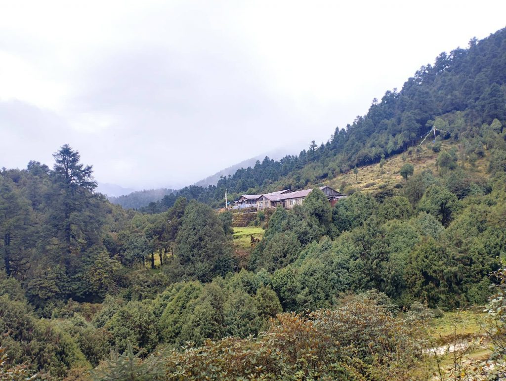
After breakfast, we began to climb up from there. It was hot while we were climbing up though it was cloudy. From tea-break place at Dursagang, weather got misty and began to rain. We kept climbing up using raincoat and umbrella inside the jungle. Shepherds were getting down from higher areas. After long climb up, we stopped at Fobrang for lunch.

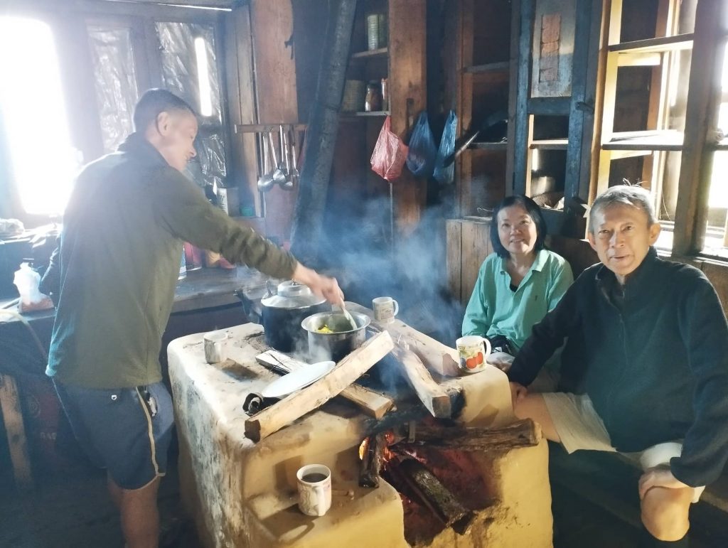
Due to cold at dining hall, we all lived around the fireplace in the kitchen which made different impression to our clients. After hot and fresh lunch, we followed the gradual uphill through pine forest. But it kept raining with very misty weather. Finally, we reached to Sing Gumba by passing quite muddy and slippery trail.

Day 10. Sing Gumba to Gosaikunda lake 4380m – 7hrs

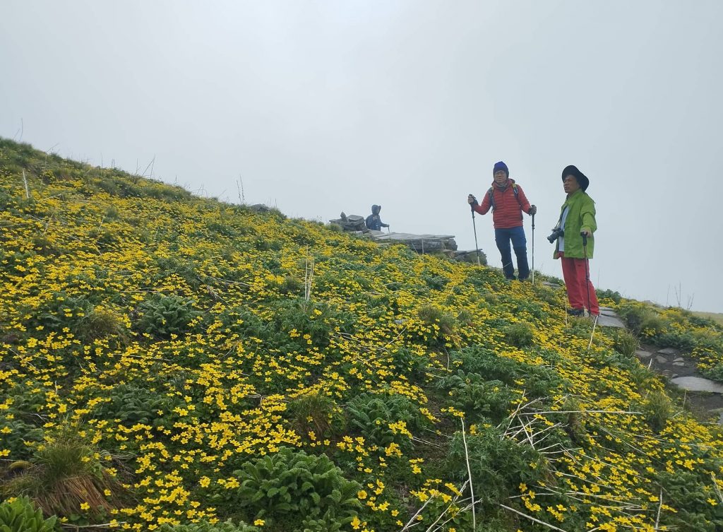
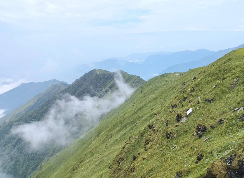
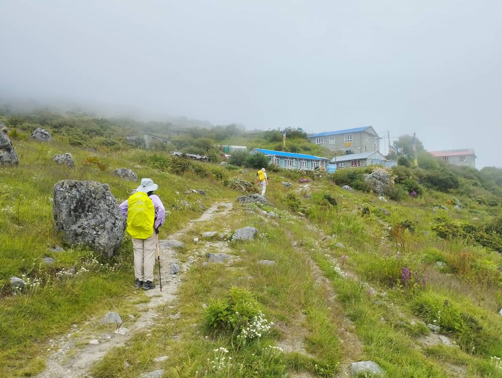
It was quite misty weather since morning. We left Sing Gumba at around 7.30 am. We climbed up continuously through pine forest again. Trail wasn’t muddy like previous day. We had tiny hope of seeing mountains from Lauribina.

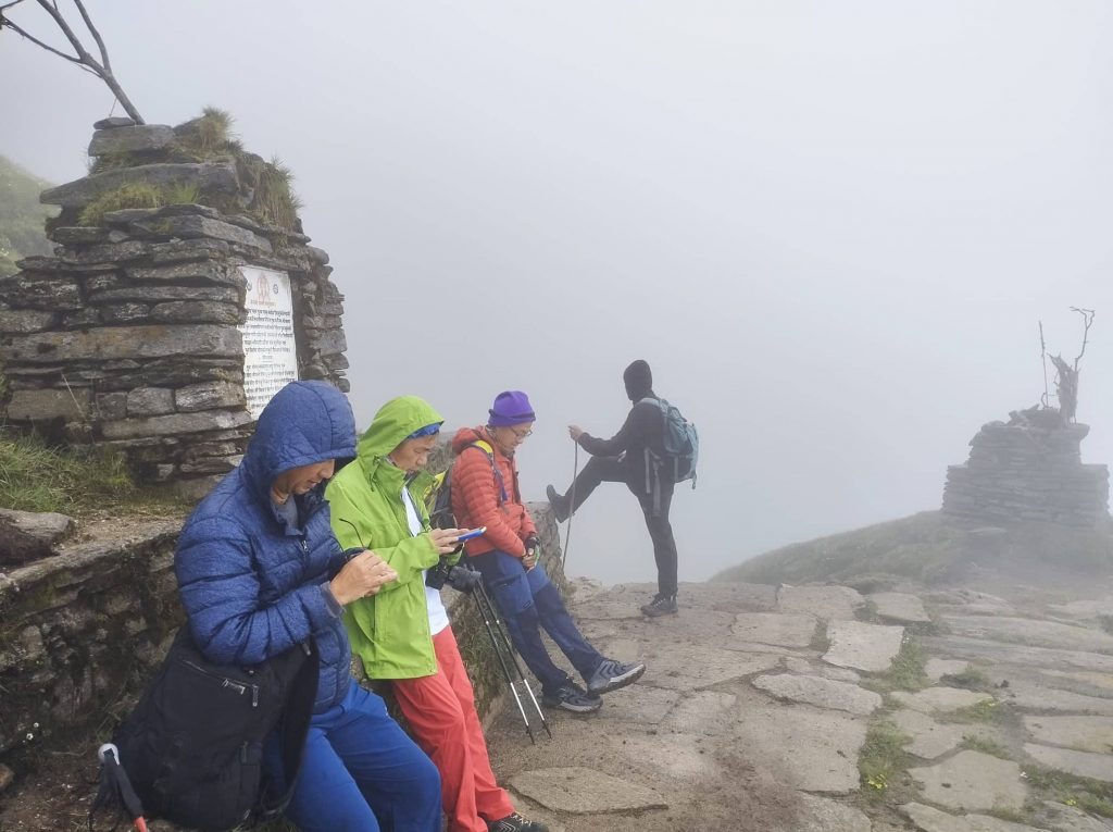
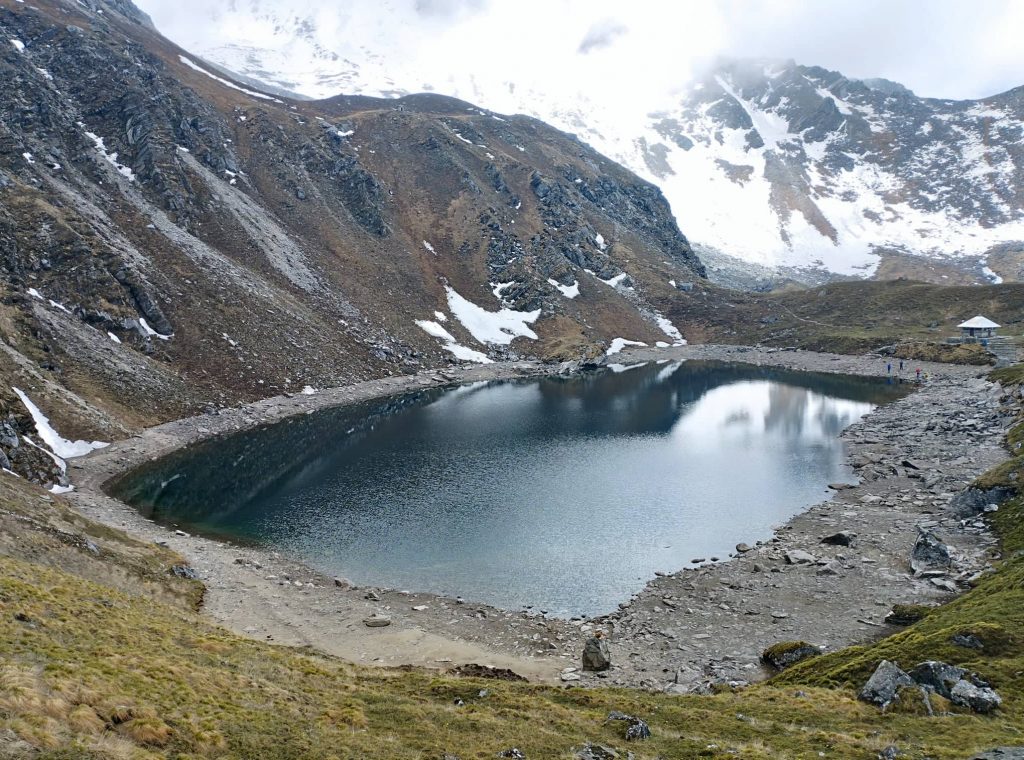
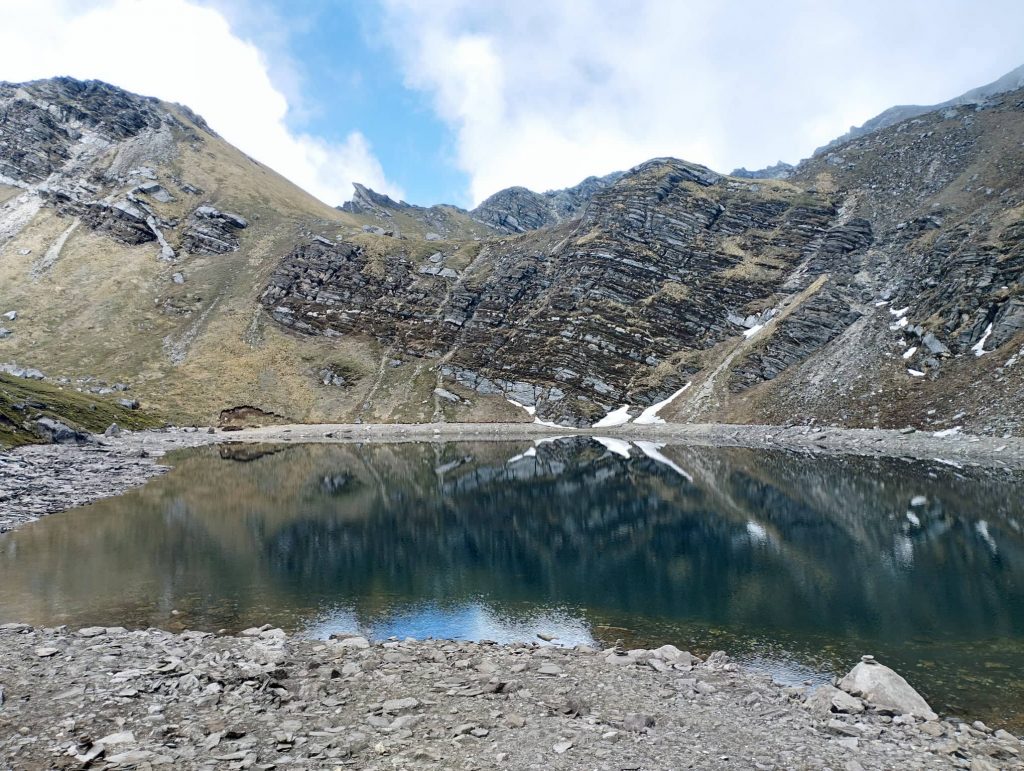
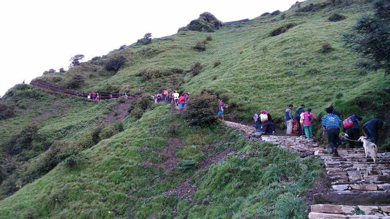
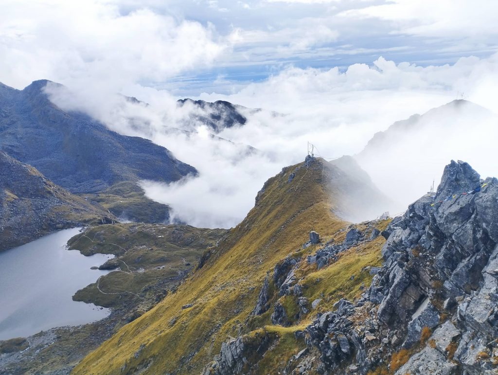
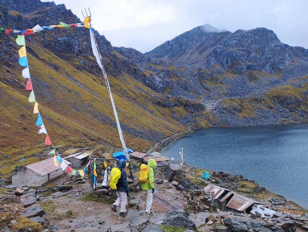
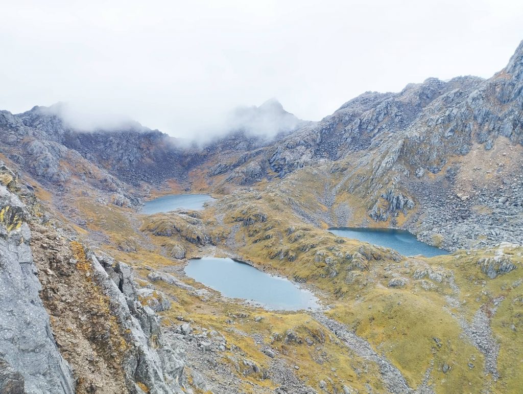
It was nice sceneries of seasonal flowers and beautiful pine trees on the way. We took tea-break at Chyolongpati and headed to Lauribina for Lunch. It was a bit crowded in our lunch place. After lunch, we began to climb up again. It kept raining with misty weather. Our tiny hope of seeing mountain views was also over. Surprisingly when we crossed the top of the Lauribina and turned towards the lakes, weather began to get clear. Gradually first lake, Saraswati Kund, was visible downwards. Then second lake, Bhairav kunda, also appeared very clearly. Our clients looked very happy to see that great views after daily misty weather. When we reached to our teahouse at Gosaikunda at around 3.30pm, Gosaikunda lake was also shining in the right side. First time, we saw almost full of clients in the teahouse.

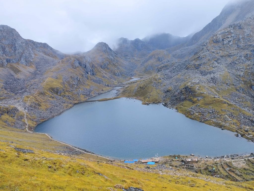
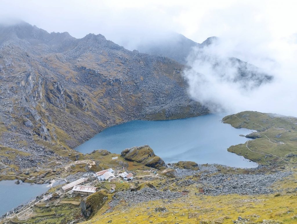
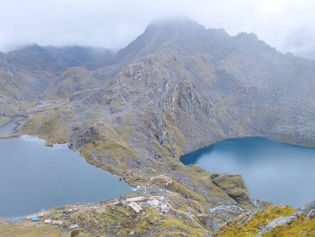
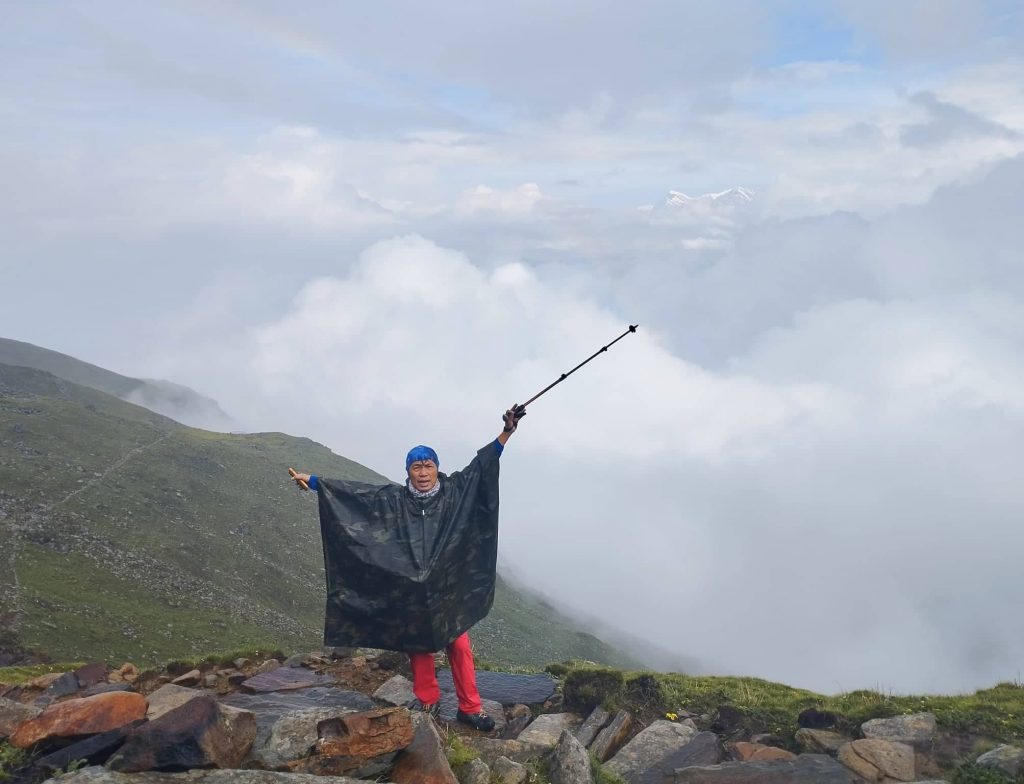
Weather was getting further clear. So, i decidded to climb to top alone instead of making crowd in the dining hall. It was steep up but view of Gosaikunda lake and Bhairavkunda lake looked like twins downwards. Another surprise, when i reached to top, other side was still misty, Gosaikunda side only clear.

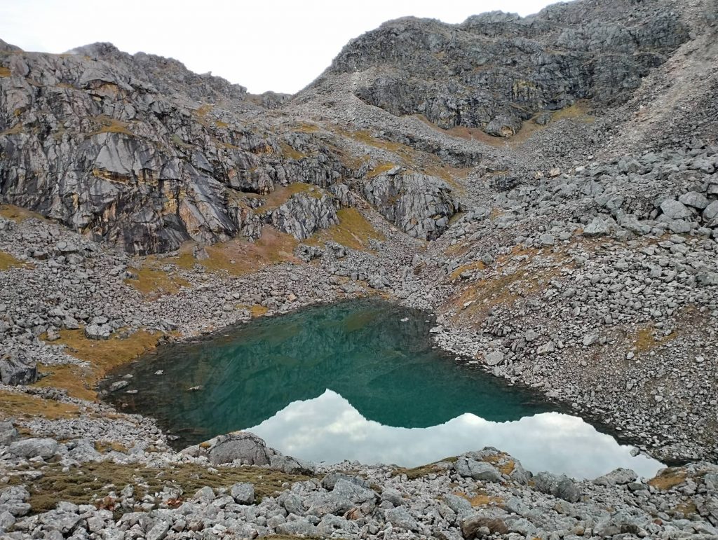
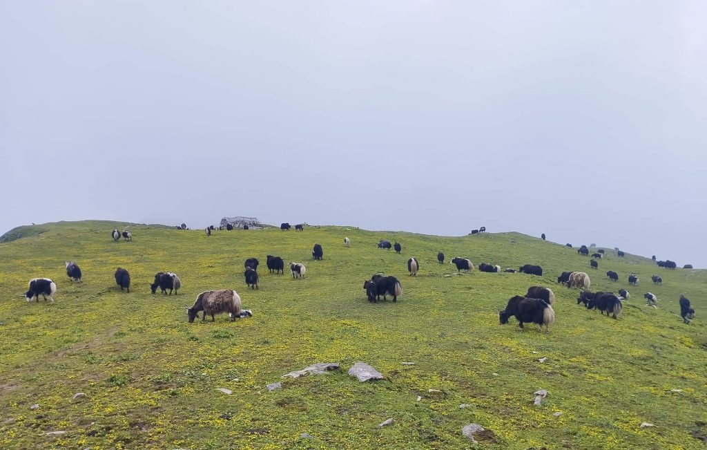
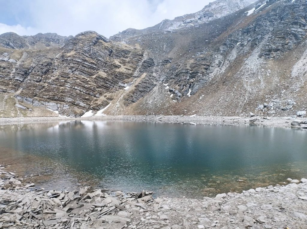
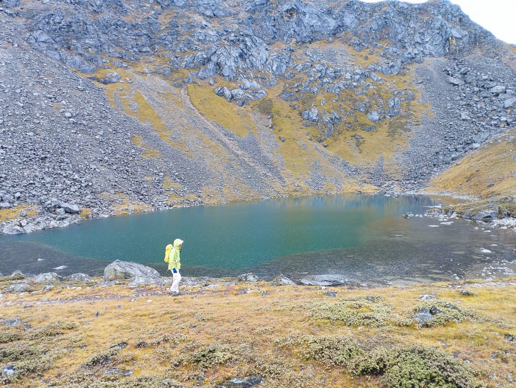
I had heard there are many lakes around the Gosaikunda. So, I got curiosity to see behind of another hill. Gradually weather also got clear. Snow peaks were also visible in far distance. There was beautiful pastureland of shepherds. I got to a beautiful lake as well which is invisible from Gosaikunda side. Then i got back to Teahouse by shepherd’s trail in the evening.

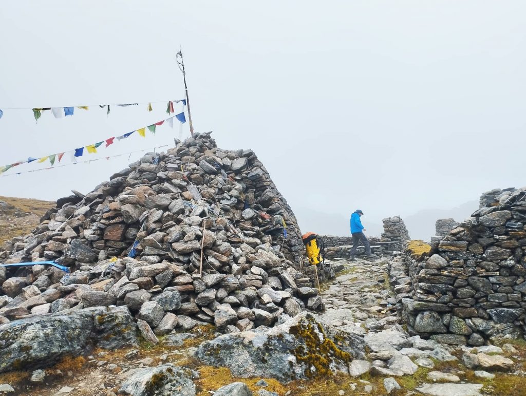
Day 11. Gosaikunda to Ghopte 3430m — 7/8 hrs

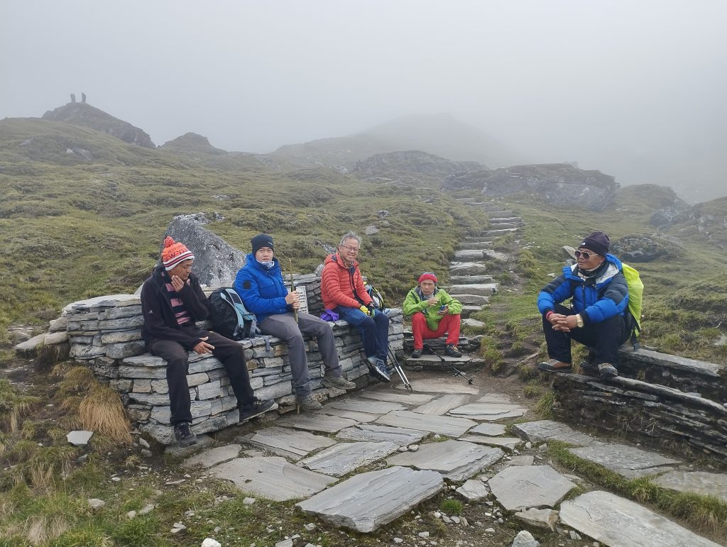
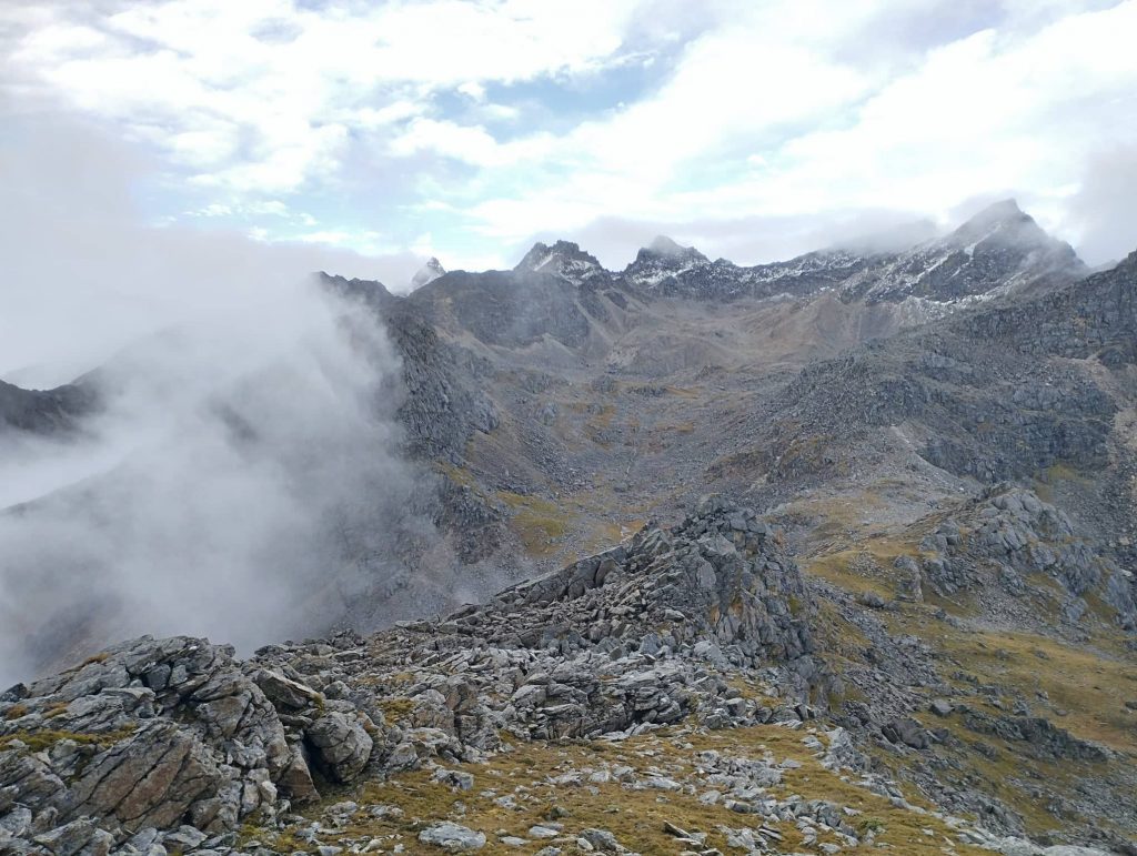
Despite the heavy rain at night, it was cloudy in the morning. At least lakes were visible from our teahouse. we began trek early due to long distance. It wasn’t easy to climb up from Gosaikunda lake to Lauribinayak pass. But there were many beautiful lakes along the way.

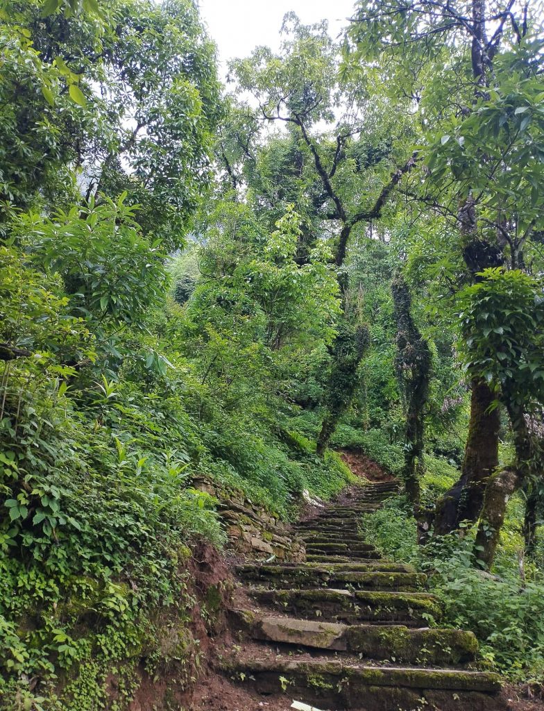
After passing Surya Kunda Lake, we began to descend through stone steps all the way. We took lunch break at Phedi. Then we had to walk uphill and downhill frequently. There were numerous newly built wooden bridges along the way. Finally, we reached to Ghopte after tiring trek.

Day 12. Ghopte to Kutumsanga 2470m –7/8 hrs

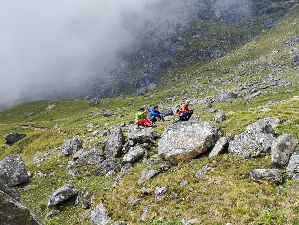
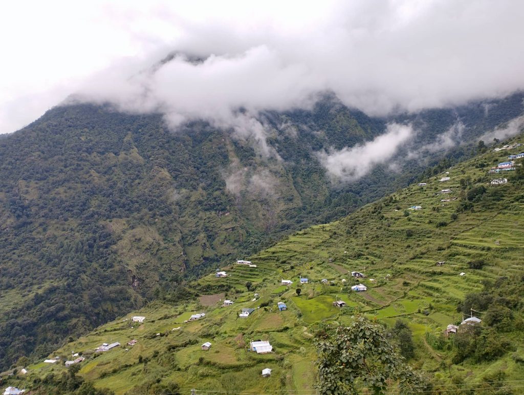
After many days, it was clear weather in the morning. Downwards, rural views looked really beautiful. Initially we descended a bit from Ghopte and gradually climbed uphill inside the forest. Variety of birds were singing along the way morning time.

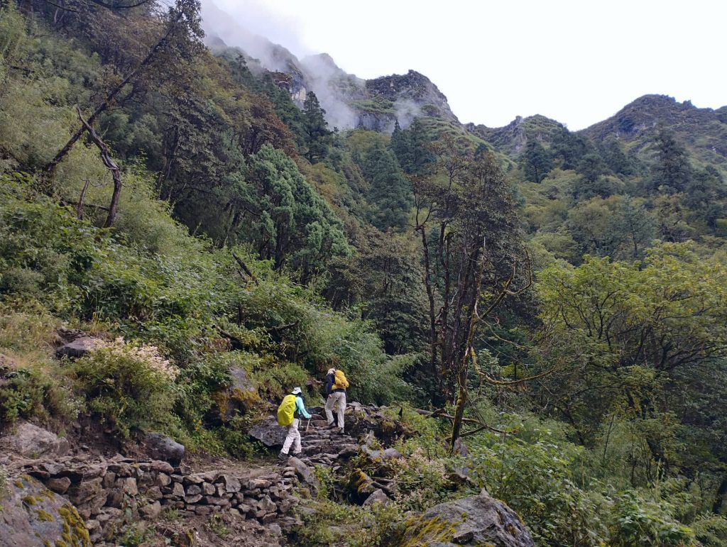
Due to teahouse closed at Thadepati, we skiped our tea- break and headed to Mangingoth for Lunch. Weather got misty again. Except few landslide parts, it was easy trail through the mossy forest of pine and rhododendron. We stopped at Mangingoth for lunch. It was single wooden teahouse which our clients also liked very much.

Then we continued our trek again with light rain. After passing thick Rhododendron forest, we descended very long through Oak forest. Because of raining, trail was very slippery along the way. Finally we could be able to reach to Kutumsaga after several times  slipped on the way.

Day 13. Kutumsaga to Chisapani 2300m — 7/8 hrs

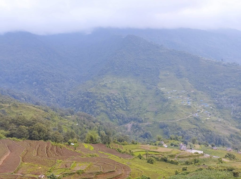
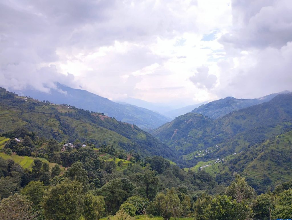
It was another long day trek. So, we began our trek around 7am. Shortly after leaving Kutumsaga, we passed local jungle and descended to Patibhanjyang including great valley views. Then we climbed uphill and took a tea-break at Thodong which is a small village of Helambuli. From Thodong, we followed easy trail for a while and descended untill Chipling.

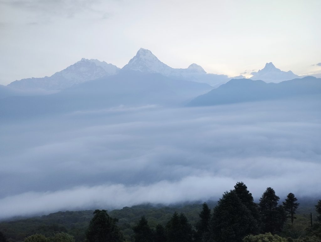
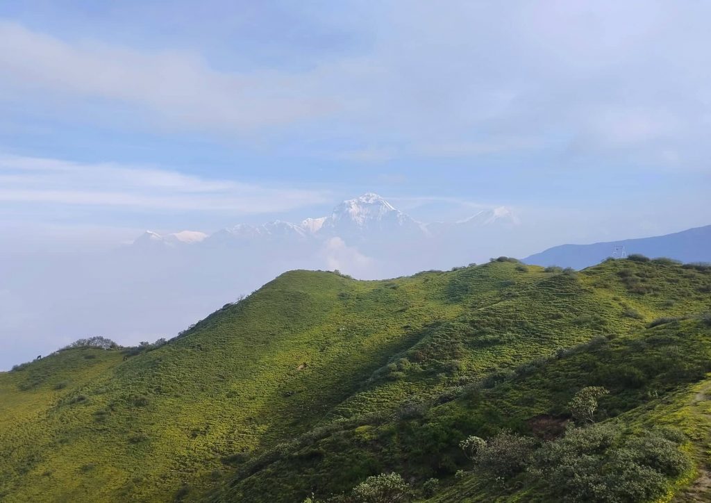
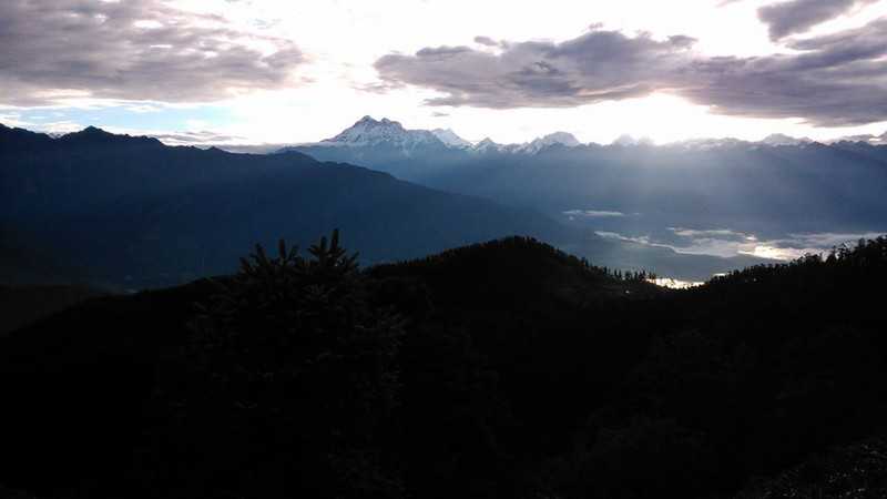
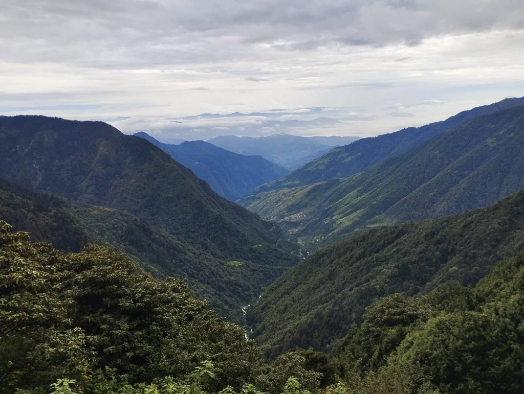
We had to choose new teahouse at Chipling for lunch. Our regular tea- house was busy for preparing foods for a big group of domestic tourists. First time during our trek, it was sunny. Villagers were drying corn at almost every house for flour. After lunch we had to descend again through the villages. Heavily rained on the way. From Patibhanjyang, we ascended again until get to Chisapani. It was getting clear weather. Some snow peaks were also visible to some extent.

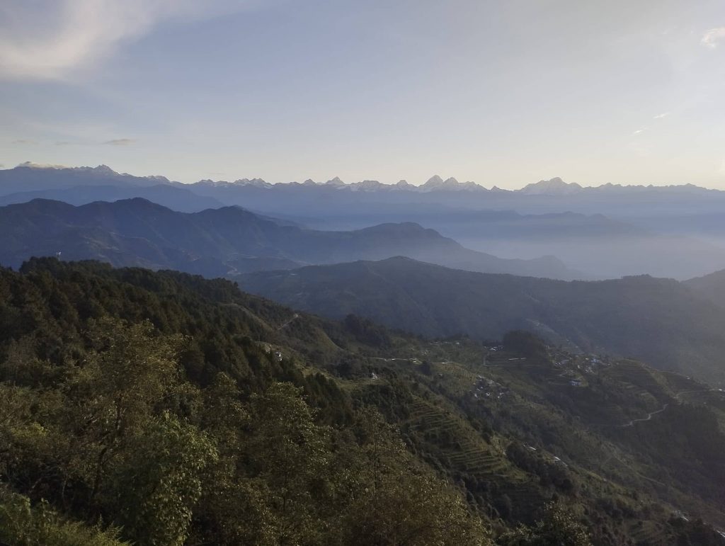
Day 14. Chisapani to Sundarijal — Kathmandu — 5/6 hrs

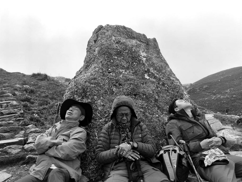
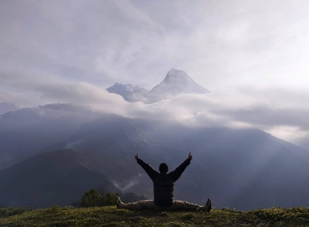
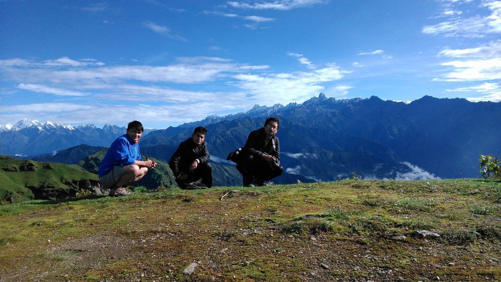
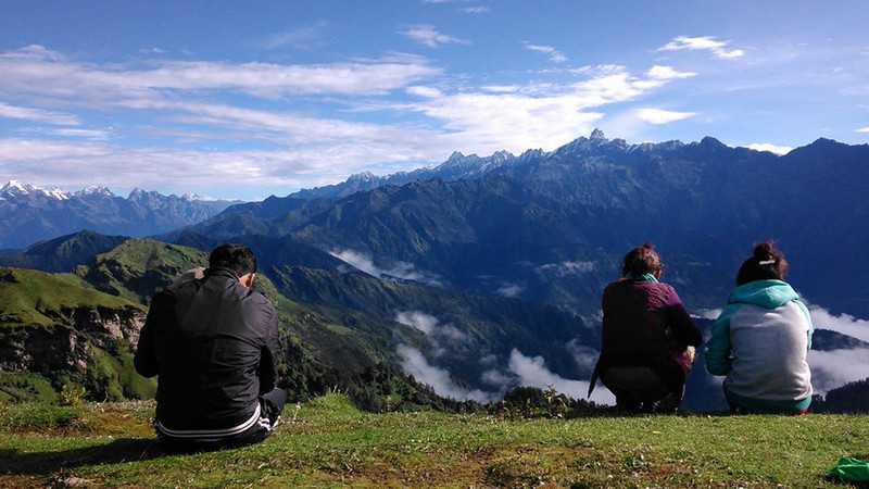
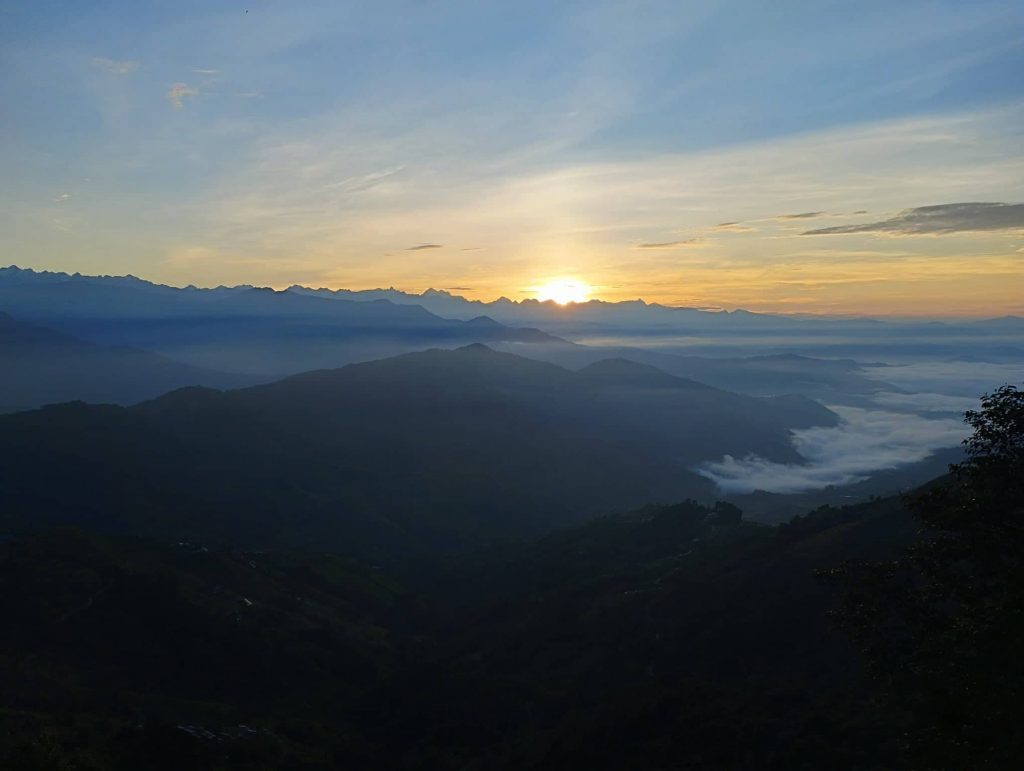
When we got up in the morning, weather was super-duper clear. Very long himalayan range was clearly visible. Finally at last day, we enjoyed the panoramic Himalayan view and sun rise view from Chisapani. After breakfast, we headed to Shivapuri national park. Initially we climbed uphill around an hour then descended down through thick forest. We took tea-break at Mulkharka but drank Coca-Cola.

Then we descended again through villages. We had our lunch nearby Sundarijal. Our food was really delicious, best Dal – Bhat in entire trek. After lunch, we descended to Sundarijal by half an hour and rode a jeep to Kathmandu

Yala Peak Trip

Day 01. Kathmandu to Syabrubesi 1450m – 8hrs

We left a bit late by bus after shopping in Kathmandu. We managed to get to Trishuli for late lunch by passing Thankot – Galchhi.  After having Dal- Bhat, we were driven again by passing frequent check- post along the way. Because of experienced and local driver, we reached to Syabrubesi at around 7:30 pm. Despite the tiring drive, our group members looked very interested to share theirs’ views and experiences of the day at each other.

Day 02. Visit to Goljung and back to Syabrubesi 1450m

Because of long drive at first day, we had our breakfast a bit late. Then we headed to Goljung village by Bus to visit local school. We were warm welcomed to office of the founder and principal of school. School principal briefed us about the school condition and discussed for mutual cooperation to reform school.

Later we had nice sharing and meeting with student group as well. Then we were served organic local food for lunch. And we drove back to Syabrubesi again late afternoon.

Day 03. Syabrubesi to Rimche 2500m – 8hrs

After breakfast, we set off to lama hotel. We followed the langtang river along the way by passing few hydro station and tea- houses at certain places. After tea- break at Dovan, trail turned uphill through jungle from initial flat & zigzag way.

We had our lunch at Pairo which was earlier than our supposed place at Bamboo. Then we continued our trek mostly uphill observing wild beehive, white monkey Langur and many more things along the way. Finally, we reached to Rimche around 5pm which was pretty faster than we assumed earlier. After dinner, they followed theirs’ sharing program outside even by ignoring cold.

Day 04. Rimche to Langtang valley 3500m – 7hrs

We were a bit late to start trek. It was perfect day for hiking due to cool and a bit cloudy weather though we were unable to enjoy with glimpses of langtang lirung on the way. Group members were very excited to catch up the sceneries as many as possible.

So, we got to Riverside only for tea- break. After tea break also we could not catch up our previous day pace. We got to Ghoda tabela for lunch around 3 pm which was pretty late than our supposed time. It started raining heavily with thunder. Fortunately, no heavy rain after leaving from Ghoda tabela. We were able to reach Langtang village at around 7pm. As usual they looked very eager to express theirs’ feelings of the day in-front of camera.

Day 05. Langtang to Kyangjin 3800m – 4hrs

It was pretty clear day in the morning. We had really beautiful view of Langtang village just at the buttom of the Langtang himalaya. Snow peaks were shining with sunrise, buddhiest religious flags were flattering at every houses. After late breakfast, we headed to Kyanjin gumba by passing numerous buddhiest monuments.

It was beautiful landscape along the way. Although it wasn’t much higher elevation few of them got mild AMS symtoms. After lunch we visited Kyanjin Gumba and then enjoyed some time at local bakery. 9 out of 11 members decided to trek to Tserguri instead of Kyanjin ri next day.

Day 06. Hike to Tsergu ri 4985m and back to Kyangjin 3800m – 10hrs

After breakfast at 4 am and a short physical warm-up, we left around 5 am. It was a wonderful day with blue skies. After about 30 minutes of easy going, we started climbing uphill. At first it seemed much closer than our estimated time.

So, some of our members seemed a bit skeptical about our estimated time as well. But it was a really long uphill. Although the trail was steep, the higher we climbed, the more beautiful views we could see. Finally, all of them reached the top within our estimated time of 12pm. We were very lucky to have a 360-degree view with blue skies.

When we descended from the top, clouds began to cover all around. It took about 10 hrs. us to do up and down. Everyone seemed quite tired. Few of them got mild AMS symptoms as well. Later in the evening, we adjusted our original itinerary and decided to rest in Kyanjin the next day.

Day 07. Rest day at Kyangjin 3800m

It was a rest day. We all spent most of our time in our own way. For some with mild AMS symptoms I suggested staying in the Kyanjin rather than climbing further up. But everyone decided to go to Yala base camp the next day.

Day 08. Kyangjin to Yaka base camp 4600m – 7hrs

We left kyanjin around 8am with all our camping gears. We sent some of our friends and Mules in-front to Yala base camp to set up camp. The weather changed and it was raining since morning. Initially we followed the way to Tserguri and took a right after about 2 hours.

The path was easy through beautiful pastureland. On the opposite side, glimpses of Naya-Khang, Ganjala pass and Gangchenpo could be seen from time to time. It started snowing on the way. The last part of about an hour was very steep. All members managed to reach base camp. We enjoyed Chinese Hot pot with Dal Bhat for dinner. But one member of our group looked very tired with AMS symptoms.

Day 09. Try to climb up Yala peak and back to Kyangjin 3800m – 10hrs

Few of us got up around 3 am in the morning to prepare hot water and breakfast.  One of our members who was suffering by AMS was at same condition. We decided to rescue by helicopter after consulting with him. But it was pretty cloudy weather and began to snow fall since early morning. 7 out of 11 decided to continue hike and headed to Yala peak.

Due to phone signal problem at base camp, I also followed the group and contacted to Helicopter from where got the phone signal. Helicopter agreed to rescue from base camp. But continuously kept snowing. All members returned from halfway due to bad weather. We waited at base camp with expectation of getting clear weather. But at one hand there didn’t seem any signs of getting clear weather and at other hand it was too risky for him to stay longer at that elevation. As soon as group descended from base camp, I told him to descend slowly. But he could barely move his legs. At the same time, he asked me is that snow-leopard by showing big rocks nearby. I realized that it is completely impossible to descend by himself. So, I quickly consulted with my staffs to take him down by carrying ourselves. Then mainly two of our staffs carried him by using rope turn by turn.

It was really challenging to carry down human through narrow path in the mountain. Slowly he felt a bit comfortable for breathing. After several attempts, he was finally able to be urinated. Then we all felt great relief though his condition was very weak. Finally, we could manage to bring down him from base camp to Kyanjin. After descending about 800m from base camp, we hoped that he would be out of danger. But he could hardly walk. So, we decided to rescue him by Helicopter next day.

Day 10. Kyangjin to Rimche 2500m – 8hrs

3 of them including our group leader and a staff were waiting Heli at kyanjin since early morning. Rest of the members descended back to Rimche. But due to bad weather, even in Kanjin, Heli could not come on time. It was only around 11 o’clock that Heli rescued our friends from Kyanjin.

Day 11. Rimche to Syabrubesi 1450m – 6hrs

We trekked all the way down to Syabrubesi and drove to Kathmandu by Bus next day.

Khopra dada (Khayar lake) Trek

Day 01. Kathamandu to Tikhedhunga 1600m – 9/10 hrs.

We left Kathmandu by Van early morning due to long journey up to Tikhedhunga. We tried to pass before moving the Kathmandu to Pokhara tourist buses. But it was still traffic jam somewhere on the way due to narrow and muddy road. We could not see mountain views due to hazy weather. Because of hot temperature, our guests preferred air-con continuously inside the Van. But i felt very cold and had to wear my jacket due to unfamiliarity with air-con. We took lunch break at Kuwa. We all enjoyed with Nepali food Dal- Bhat.

Then we directly moved to Nayapul from where the vehicle had to be changed due to the dirt road. Jeep took us by passing Birethanti, Sudame. It was pretty greenery scene with beautiful Burundi river along the way. Finally, we reached to Tikhedhunga at around 6:30pm. As the day was long, the sun had not yet set. So our group enjoyed with playing water at Burundi river.

Day 02. Tikhedhunga to Ghodepani 2860m — 7 hrs.

It was pretty clear weather in the morning. Everyone was quite excited to start hiking. After leaving from Tikhedhunga, we had to climb up all the way. There were only few other hikers on the way. we took tea break at Ulleri and headed to Banthati for Lunch. We enjoyed with warm sun during lunch break. After lunch we left the village and entered inside the forest.

Our group looked getting refreshed from greenery and cool weather. It was almost rained when we were at Nangethati. But luckily no rained untill we got to Ghorepani, our overnight place. As soon as got to Ghodepani, it was light rained. During dinner time, we decided to go to Punhill next day early in the morning.

Day 03. Ghodepani to Punhill to Swanta 2214m –6 hrs.

We got up at 4 am and headed to Punhill despite the misty weather. From half way, surprisingly weather began getting clear. We rushed to catch up the view from Top. When we reached to Punhill, Annapurna and Fishtail range was pretty clear. There were only less than 20 hikers.

After sun-rise, Dhaulagiri range also got clear in west. We could enjoy long panaromic mountain view. Then we got down to Ghodepani again and set off to Swanta  village after breakfast. It was easy and short trekking day. we descended all the way up to Ghar Khola by passing jungle and few small villages.

We had chance to taste wild strawberry along the way. After crossing suspension bridge at Ghar Khola, we had to short climb up to Swanta. It was beautiful village with good lodging-fooding services for tourists. It was pretty sunny day but not sure about next days due to starting of monsoon. So, we all dried our hiking gears very well. After having fresh lunch, we spent our time in our own way. Two of us visited around the village and Thado Jharana (waterfall) as well. Waterfall was really much more beautiful than we thought initially.

Day 04. Swant to Khopra dada 3660m — 8/9 hrs

After breakfast we took a group photo with the lodge owner. Then we started our trek by horizontal path. As soon as leaving Swanta no more villages.It began jungle along with fresh greenery.

Hiking trail was also original path of villagers. No one met on the way except various types of birds along the way. When we reached to mini hydro station closer to beautiful waterfall, then uphill began. We met also a big group of sheeps grazing in the forest. And we passed some shepherd’s hut which was a bit smelly around. Just before getting to lunch place at Sistibung, a very beautiful mossy forest appeared. Our group liked very much that mossy forest and took a lot of photos as well. we had very fresh Dal- bhat with omlette at Sistibung and climbed up again. It was cool hike with misty weather.

We kept climbing uphill continuously. But it took quite longer than we supposed time to get to Khopra dada. Despite the many hours trek, i climbed a bit further up than Khopra dada where hundreds of Nak/Yak were grazing everywhere. Dozens of Dozen calfs were also following theirs’ mother. It was really peaceful and pleasant atmosphere. Latter i got back to Khopra dada with heavy rain.

Day 05. Khopra dada 3660m to Khayar lake 4660m to Khopra dada 3660m — 11 hrs.

It was the longest and most exciting day hike due to our main destination Khayar lake. So we started our trek early morning at 5 am. It was pretty misy weather. After Khopra dada, it was all open pasturland.Initially we had to climb up around 1:30 hrs. Then came horizontal path and began raining as well. There were grazing many Nak/Yak along the way.After raining, weather got clear and appeared Mt. Dhaulagiri also in far west.

From the buttom of the Deurali, we had to climb steep up. It took more than 5 hrs. us to get to Khayar khola from Khopra for lunch. Khayar khola is located in flat area where one of the local men has been serving basic foods for trekkers  or pilgrims. Now he is trying to build up a lodge also there. Few of our friends returned back from Khayar Khola and rest of us headed towards the Khayar lake. After half an hour easy way, it was all the way up through stone staircases. We kept climbing by taking rest at few places. Because of too tired it was something like never ending climb up for us.

To be frankly, i was also really tired and rememberd the Larke Pass in Manasalu.

Finally we reached to Khayar lake after 3 hours from lunch place. Everyone looked in happy and excited mood from exsusted mood once again. Our youngest friend looked further overwhelmed.

The lake was really beautiful surrounded by small hills around.There were Temples and rest house as well for especially pilgrims. A big festival falls on full moon day of August annually there. Hundreds of local pilgrims visit this sacred lake during this festival. They even sacrifice hundreds of sheep (male) and goats.

Fortunately weather also got clear partially while we were hanging around the lake. Annapurna south looked very closer from this lake. After spending worth time at lake, we all descended same way to Khopra dada.

Day 06. Khopra dada to Dobato 3300m — 7/8 hrs.

We got up early despite the long day hike previous day. It was cloudy weather. But fortunately it got clear weather for a while and could see both Dhaulagiri and Annapurna ranges. After breakfast we got down from Khopra dada. One of our friends began to collect wild vege again. We took tea-break at Sistibung and headed to Bayali kharka carrying a bit salt also for leeches. It was especially shepherds’ trail inside the thick forest.

We got countless leeches all over the shoes. Salt helped us a lot to control leeches though it was impossible to remove all. After an hour easy way from Sistibung, we climbed uphill all the way to Bayali. We passed numerous streams and waterfalls along the way. what a great coinccident when our group reached to Bayali, heavily heavily rained more than an hour. It was the heaviest raining during our entire trip. When rain stoped, we headed to Dobato. It was easy way with greenery along the way. we took around 2 hours to reach Dobato. First time, other trekker also saw at same tea house with us. An American guy was with his guide.

Day 07. Dobato to Mulde view point 3600m to Ghandruk 1940m — 7/8 hrs

Despite the misty weather, 4 of us climbed up to Mulde view point at around 5am. It was just half an hour hike. When we reached to view point, dramaticlly weather got clear. South Annapurna and Nilgiri would look very closer. Gradually Dhaulagiri range also got clear from clouds. We got even better view from Mulde than from Punhill.

Then after breakfast at Dobato, we set off to Ghandruk downwards. It was pretty original trail used by mostly shephards. We passed mainly Rhododendron forest with greenery and misty weather along the way. Our friends were comparing that forest scene with some movie scene. As we supposed, we got to Tadapani for lunch and headed to Ghandruk with last tea break at Bhaisikharka.

We complited our trek without heavy rain on the way even during monsoon. We had much more better weather than we expected before the trek. Our group looked pretty happy and satisfied with trek. So they enjoyed with Beer and served to all staffs as well.

Next day, our group got back to Pokhara by Jeep.

Mardi base camp Trek

Day 01. Ghandruk — Low camp 2970m — 9/10 hrs.

After having breakfast and group photo with my Khopra trekking group, I started Mardi trek alone from Ghandruk. I descended until Sudame and had a pancake with hot lemon at our regular place. Then I crossed Modi River and ascended uphill. It was too hot due to sunny day. Annapurna south & Himchuli were shinning at left hand side. I took another break at Landruk. I bought a coke and some biscuits there for next days. Lodge owner offered me mix fried rice free of cost as trekking guide.

After enjoying lunch with Wi-Fi, I continued my hike again. It was quite steep way through stone staircase. After 1hr from Landruk, I got to Tukuche where a tea house is located. There were really superb views from Tukuche. After another 1.3hrs climbing up, I could get to Forest camp where I was looking to meet my hiking mates. They arrived about 1 hour later from the Australian camp. We had a light lunch and moved on from there.

Trail was gradual uphill through mossy forest. We met some shepherds with their hundreds of sheep. After 2.30 hrs. from forest camp, we reached to Low camp for overnight stay. Teahouses were comparatively better there than at Forest camp.

Day 02. Low camp — High camp 3550m — 3hrs.

It was pretty easy and short trek that day. After breakfast we left Low camp at around 8 am. We climbed up through Rhododendron Forest by passing few buffalo sheds as well. When we reached closer to Badal dada, jungle part almost over and opened up scenery all around. Badal dada is one of the best viewpoints for panoramic views during this trek.

Although it was only an hour’s walk from Lo Camp, we took a tea break there. Then we headed to High camp. Trail was gradual up through the hills. We got great views along the way. There were building many teahouses on the way. It took just 1 hr. us to reach high camp. We had enough time to go to Mardi base camp and come back to high camp. But we decided to visit Mardi base camp only the next day to see the sunrise from the viewpoint. So, we spent our time around high camp.

Day 03. High camp – Mardi base camp – high camp — Kalimati 1900m — 12hrs.

We set off to viewpoint at 4 am with head lamp. It was uphill way mostly through stone staircases. Weather got clear for a while during sunrise at around 5 am. But we couldn’t reach the viewpoint at that time. When we reached to top, only fishtail range was open a little bit. Surprisingly, there were many small huts for teashop at viewpoint. One of those was opened that day. We ordered coffee and waited for clear weather.

Gradually clouds moved away from fishtail range and appeared amazing views including Mardi Himal. Then Annapurna south and Himchuli also looked very closer for a while in another side. ABC trail was also clearly visible downwards from Viewpoint.

Then we headed to Mardi base camp through open hills. if it was clear weather, definitely great views would be visible all around. Varieties of seasonal flowers were blooming along the way.

It took us 2 hrs. to get to Mardi base camp from Viewpoint. There was a hut for teashop even at Mardi base camp which was closed that day. Some horses and mules were grazing nearby base camp. Weather didn’t get clear when we were there. We missed the majestic view of Fishtail including Annapurna one.

We retraced back from base camp. We were already hungry, but the teashop was closed even at the viewpoint. So, we went to Nak shed on the way and drank Nak milk and cheese. Then we came down to high camp and had our lunch. Although it was going to rain, we descended back the same way to Forest camp. Then we turned left and descended again. It was quite original trail of villagers inside the forest. There were many cow sheds on the way. Finally, we reached to Kalimati village near the jungle. Kalimati village is located at hillside. From there, we enjoyed a beautiful view of farmland and other villages below.

Day 04. Kalimati — Lumre — Pokhara 900m — 4hrs

After breakfast, we descended through bamboo forest and then passed traditional village Ghalel. When we got down from Ghalel, a beautiful hydro-waterfall was visible in the background of Lumre. We ended our hike at Lumre and rode bus for Pokhara.

Holy Place Kalinchok Trip

Kalinchok is a sacred religious site for both Hindu and Buddhist. Especially on full moon day of August, every year there is a wonderful gathering of devotees. So we 3 friends also decided to go at the time of the fair. One day before the fair, we took a bus from Kathmandu to Charikot via Araniko Highway and then started trekking to Kalinchok.

We slowly climbed up, met many pilgrims one after another on the way. Although we didn’t have enough time, we took a break at Deurali for lunch. There were no villages after Deurali, just dense forest. But along the way, there were other pilgrims and visitors. So, some of them were singing and some were shouting. It was a kind of fun. Because of rainy season, as usual it was quite foggy, the forest was full of greenery and flowers of different species. After walking for about 3 hours, we reached a tea shop, there was no place to stay as there were many peoples inside, we had tea and biscuits sitting outside.

Then we climbed up again. It began to rain. Peoples were using umbrella and plastic which looked colorful scenes on the way. The cold weather, the uphill trail made it a little difficult for my friends to walk. I went ahead to book a room because so many visitors were going up. It took about 2 hours for me to get to Kuri bazar. It was not difficult to find a room even though there were many visitors. Actually, before Kuri was just a open pastureland for shepherds. Latter began to build up lodges also for pilgrims and other visitors.

About 1.30 hours later, my friends also arrived. I was busy for watching the shamans coming from different villages. After resting for a while, we headed towards the nearby Yak huts. As the shepherds were milking, we didn’t get a chance to taste the butter tea and cheese as we had hoped. After that we went back to the lodge. The main Kalinchok hill is about 40 minutes above Kuri Bazaar. The fair was going to start in Kalinchok from that evening. Because of exhausted, my friends decided to stay in the lodge, but I went to see the fair for a while. The road was not as smooth as i thought, it was muddy and slippery. Coincidentally i met 2 local boys. So, it was not difficult to know the way. When we reached the top of the hill, the atmosphere was different. There were some temporary huts of small shops. Irrespective of the fog and rain, the young men and women were dancing and singing in the groups. Because of raining, i didn’t feel interesting. So, I just visited the Kalinchok temple and returned to lodge at Kuri. My friends were doing body massage.

Fortunately, the weather was very clear the next morning. Other pilgrims and shamans started climbing the hill early in the morning to see the goddess on an empty stomach. We also hurried up the hill to see the view of the mountains from the top. The view from Kalinchok hill was truly amazing. In the background, to the north, Gauri Shankar, Pathi Bhar, Dorji Lhakpa and various other mountains were visible very closely. Even though it was far to the south, Shailung, the highest hill in the Mahabharata range, was clearly visible. In the lower part, thick white clouds seemed ready to rise up.

After taking a lot of photos, we also lined up with pilgrims to pay homage to the Goddess. The place of the goddess adorned with innumerable tridents and bells at the top of the hill is truly special. As usual, after sun rise gradually the clouds began to cover everything. Then we also got down to Kuri bazar and had our breakfast. After having breakfast, we came down the same way and stayed in Dolakha. On the morning of the third day, we visited to Bhimeswar temple and returned to Kathmandu by bus.

Note : Nowadays there is road access up to Kuri bazar. One can go to Kalinchok by Jeep also without hiking.